The rise of drone mapping in construction: speed, accuracy and efficiency from the sky
.svg)

Quick Summary
Drone mapping software replaces slow, error‑prone traditional surveys with automated, high‑accuracy aerial data – giving project teams fast insights, full site visibility, and reliable measurements without heavy boots on the ground. By supporting everything from orthomosaic maps and 3D terrain models to cut/fill analyses, tools like DroneDeploy deliver real cost savings, improved coordination, and smarter decisions across construction workflows.
The construction industry runs on precision and speed. But traditional surveying methods slow teams down and leave too much room for error. That’s why drone mapping software has become a go-to tool for forward-thinking general contractors.
By replacing outdated site documentation with automated, high-accuracy aerial imagery, drone mapping gives project managers what they need most: fast insights, reliable measurements and full visibility – without setting foot on site.
The evolution of mapping in construction
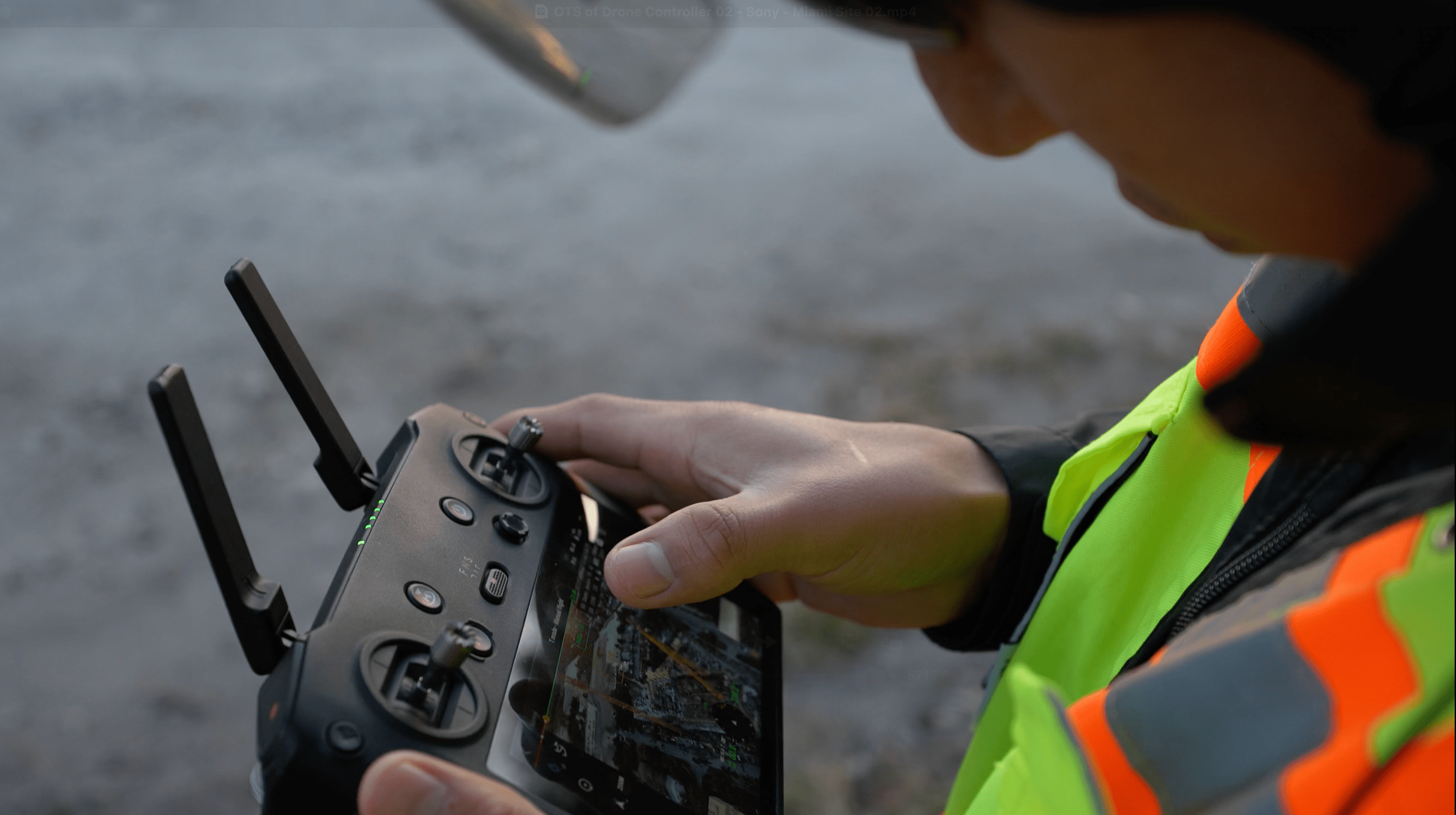
In the past, the construction industry relied on manual total station measurements and infrequent satellite updates. Now, drone mapping is mainstream, providing real-time data at centimeter-level accuracy. Weekly or even daily drone flights capture and convert site conditions into actionable insights.
With a single drone flight, teams can generate:
- Orthomosaic maps
- High-resolution progress photos
- 3D terrain models
- Cut/fill reports from accurate aerial surveys
This evolution has changed the way construction projects are managed. Drone mapping software like DroneDeploy helps cut documentation time in half and ensures data consistency across phases. Learn more in our Construction Reality Capture overview.
Why drones outperform traditional surveying
Traditional ground-based surveys take days, cost thousands and often delay fieldwork. By comparison, drone mapping delivers faster results with fewer people. Drone flights can safely cover difficult terrain and deliver photogrammetric maps with sub-5cm precision using RTK-enabled drones.
Drone pilots can capture a higher volume of data points in a single flight, which improves model resolution and reduces rework. See the full breakdown of RTK, PPK and GCP for further clarity on positioning systems.

Speed and efficiency: a new baseline
Drone mapping software is built for fast turnarounds. One drone can scan a 100-acre site in less than an hour, enabling project managers to move faster without compromising detail.
Drone flights can happen during working hours, eliminating downtime. Data is uploaded instantly to the cloud, and stakeholders can access the results from anywhere. One contractor replaced a full day of manual inspections with a 15-minute drone flight – saving five man-hours per site visit.
Precision that builds confidence
Orthomosaic maps generated from drone mapping are orthorectified, meaning they are adjusted for lens distortion, tilt and terrain variation. That ensures uniform scale for accurate distance and area calculations.
Using RTK drones for aerial surveys allows construction teams to produce high-resolution outputs with centimeter-level precision – essential for verifying earthwork, slab elevation and utility placement.

Real cost savings, not just efficiency
The benefits of drone mapping go beyond speed. Accurate drone data minimizes over-ordering of materials, reduces errors and simplifies subcontractor billing. This means fewer disputes and better budget adherence.
Many construction projects have avoided six-figure change orders by identifying discrepancies early. Real-time documentation has become a financial safeguard.
What makes drone mapping work: the key components
Effective drone mapping requires:
- UAVs with RTK GPS for accuracy
- Photogrammetry software for map processing
- A cloud platform like DroneDeploy to store and share visuals
Together, these tools provide a unified reality capture solution that empowers drone pilots, surveyors and project managers alike.
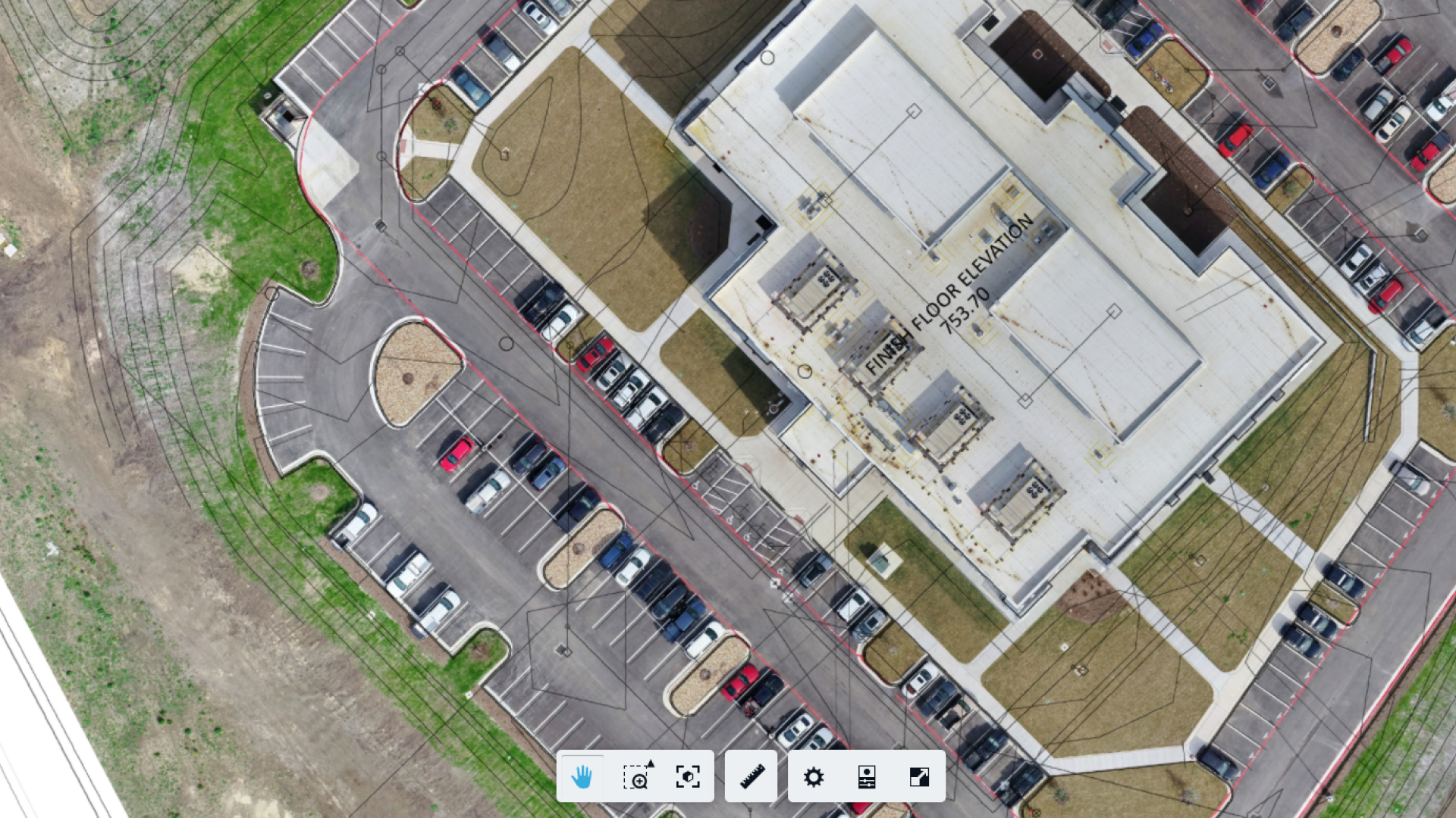
Orthomosaic maps: the foundation of site intelligence
Orthomosaics are the cornerstone of drone mapping. These high-resolution, geo-corrected maps are used across the construction industry to verify work progress, guide layout and support project documentation. From estimating to coordination, orthomosaics improve team alignment and reduce onsite miscommunication.
3D models: elevation, analysis and insight
Construction teams use drone-generated 3D models to assess grading, calculate volumes and check field conditions against plan. These models provide intuitive visuals that simplify handoff between disciplines and reduce errors during layout.

Real use cases on real sites
At the Halawa View Apartments project in Hawaii, a DPR field engineer used DroneDeploy to manage a complex build that included two low-rises and a 25-story high-rise. The team used drone mapping to monitor milestones, document active decks and track MEP rough-in before walls were framed. It became a standard part of their process – so much so that missing a scan raised internal questions.
DroneDeploy also helped the team plan crane placement on a tight site. By modeling buildings and overlaying them with drone-captured site scans, they confirmed clearances and dismantle paths that might otherwise have caused delays. The scans proved especially valuable during underground work and façade inspections, where context and safety were critical. What started as a documentation tool quickly became integral to logistics and coordination, especially as finishes began going in.
Smarter planning through better data
Drone maps give project managers and precon teams the tools to visualize jobsite realities early. Plan overlays, field condition verification and real-time data help teams reduce RFIs, catch site conflicts and align trades faster.
Continuous progress monitoring
Drone mapping makes it easy to build a visual timeline of your jobsite. Comparing orthomosaics week to week allows superintendents to:
- Verify subcontractor work
- Validate construction schedule
- Document delays and impacts
These progress photos support transparency, reduce disputes and accelerate approvals.
Site logistics and safety: real benefits from the air
Drones support logistics planning by showing real-world conditions and routing. Whether it’s defining haul roads, verifying crane clearances or flagging hazards, drone mapping helps keep people safe and workflows efficient.
AI and automation: the future of mapping is here
Modern drone mapping software incorporates AI to:
- Detect site anomalies like water pooling or uninstalled components
- Identify deviations between plans and field conditions
- Highlight elevation changes and track progress automatically
These insights help project managers make decisions faster and with greater confidence.
Better communication and accountability
DroneDeploy gives all stakeholders – from owners to subcontractors – clear visibility into project progress. The centralized platform ensures that everyone is working from the same information, reducing confusion and improving team trust.
See how Skanska boosts efficiency and aligns stakeholders using DroneDeploy.
The bottom line: unified drone mapping powers construction
Drone mapping provides tangible ROI: faster workflows, better documentation, safer jobsites and fewer delays. And with DroneDeploy, everything lives in one unified system.
Explore how Skanska does more with less software, or get started with the Reality Capture Playbook.
.png)
FAQ
Related articles


Ready to manage your data from the very start?
Book a quick call to see how DroneDeploy streamlines capture from construction through building ROI.