Mining and quarries

Get an unbiased view of every pit, plant and rail line

Document your mine from pit to plant with drones, 360 cameras and robots to build a live, shareable record that reduces risk.
Used on 3 million sites in 180 countries

Stop risking people and production for basic site data

Explore & study

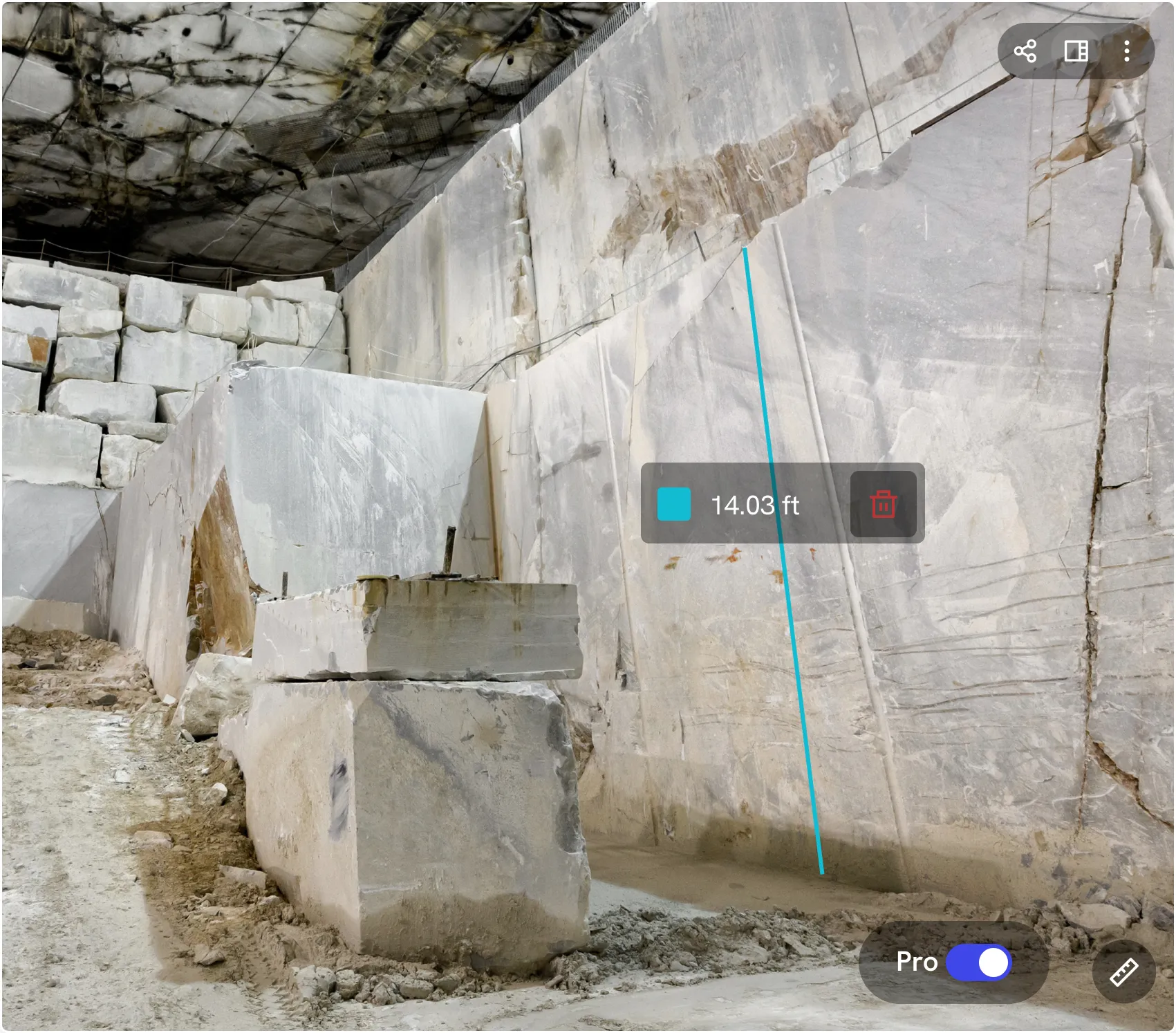
See the ground before you clear it.

Plan access roads, drill pads, geotechnical surveys and cultural heritage work with current terrain models instead of guesswork.
Extract & process

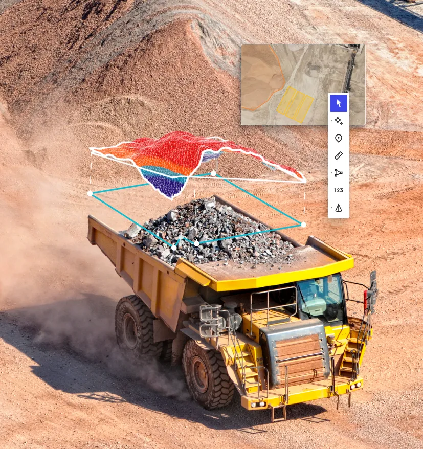
Make every blast and bucket count.

Track mine progress, highwalls, stockpiles and plants with repeatable flights, accurate cut/fill and AI‑powered volumes and hazards.
Transport & close

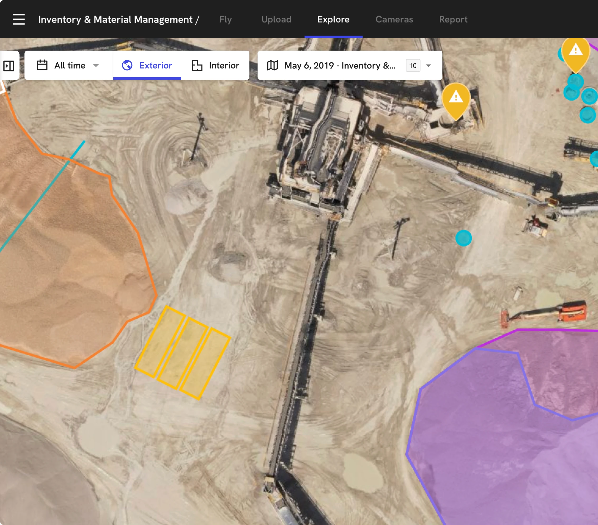
Keep rail and rehab on the same page.

Monitor rail corridors, tailings, environmental KPIs and closure work from one shared, timestamped view of the entire mine.

Capture every phase of the mine lifecycle

DroneDeploy Aerial

Site‑wide visibility in every flight
Map pits, benches, waste dumps and tailings in minutes
Produce survey‑grade DTMs and 3D models with RTK/PPK and GCPs
Compare to design for highwall, dump and rehab conformance
Measure stockpiles and ROM pads without putting surveyors on the pile
Monitor tailings walls, haul roads and dams for change over time

DroneDeploy Ground

Autonomous inspections from the ground up
Use robots to capture 360°, thermal and video inside plants and wash facilities
Track gauges, valves and sensors on critical equipment over time
Automate wash‑plant, conveyor and crusher checks so robots walk the route, not your crews
Investigate hot bearings, leaks and abnormal readings remotely before dispatching a truck
Combine ground walkthroughs with mine maps for a working digital twin of your operation

Need a full feature list and custom quote?

Supported hardware

Build your fleet
(or let us do it for you)
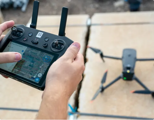
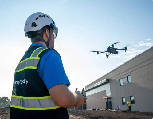
Drones

Our mining drone software captures high‑res RGB and thermal data across pits, stockpiles, tailings, and rail corridors with leading enterprise‑grade drones. Conduct simplified RTK/PPK workflows and automated GCP handling when survey‑grade accuracy is required.

Get the right drone for your mine

360 cameras

Document plants, workshops and processing facilities with fast 360° walks that give engineers, OEMs and executives virtual access to complex areas without travel or shutdowns.
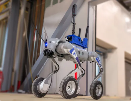
Order a 360 camera kit

Docks and robots

Deploy docked drones and ground robots to run repeatable mining inspection routes around wash plants, conveyors and high‑risk structures – creating a consistent visual history without sending people into hazardous zones.

Get a robot on your site

Data on demand

Need the data but don't have pilots or hardware yet? Use our services network to survey pits, dumps, tailings and rail spurs at the cadence you need, with processed maps and models delivered straight into your DroneDeploy account.

Get your data delivered to you
Integrations

Don't just collect data – connect it.

See all 80+ integrations

Don’t get left behind.

Maximize efficiency and safety for the life of the mine.
Operate remotely
Fortify security
Ecosystem integration
Get better data, faster
Unified site truth
Global mineral mapping
"Bring the field or the processing plant into the office, wherever it is."
Jamie Hansen
Principal Advisor
See how
"Using products that support SSO and MFA is a big deal for us."
Jamie Hansen
Principal Advisor
See how
"The ability to integrate with Esri and our internal software is a huge benefit."
Jamie Hansen
Principal Advisor
See how
"With DroneDeploy, we're able to survey 19 gravel stockpiles in just 4 hours – a task that would have taken 10-12 hours with 2 surveyors."
Kelsey Martin
President
See how
"The ability to seamlessly have a single point of truth dataset in our Esri environment without moving and duplicating data between software is massive."
Jamie Hansen
Principal Advisor
See how
"Hyperspectral imagery captures hundreds of bands of information, allowing our exploration teams to conduct mineral mapping at a global scale."
Jamie Hansen
Principal Advisor
See how
Frequently asked questions

Is DroneDeploy the right fit
 for your operations?

Do we need licensed surveyors to use DroneDeploy?

You can start with operational surveys led by mine or production teams and bring survey in where high‑accuracy deliverables are required. DroneDeploy supports RTK/PPK, GCPs, and checkpoints so your survey group can sign off when it matters most.

How accurate are the maps and measurements?

With the right inputs – RTK or PPK, good control and checkpoints – DroneDeploy delivers highly accurate maps, DTMs and point clouds suitable for design conformance checks, volume reporting and regulatory submissions.

Can DroneDeploy really keep people out of high‑risk areas?

Yes. Mines use DroneDeploy to inspect highwalls, plants, tailings dams, and confined structures from the air and with ground robots – reducing the need for rope access, working at height, and confined space entry.

Can DroneDeploy meet our security and compliance requirements?

Yes. Enterprise mining customers use DroneDeploy as a central platform for flight operations and data because it offers encrypted data at rest and in transit, role‑based permissions, and enterprise‑grade controls including SOC 2 and ISO 27001 certifications.

How does DroneDeploy help with stockpiles and inventory?

Regular, automated drone surveys paired with AI allow you to capture ROM and processed stockpiles quickly, strip away conveyors and equipment, and generate volumes and values in minutes instead of hours – without sending surveyors onto the pile.

What about tailings, environmental monitoring and closure?

DroneDeploy helps you track tailings dam condition, vegetation coverage and rehabilitation progress over time, providing clear context for regulators and stakeholders and reducing the cost and time of reconciliation inspections and reporting.

Do we need in‑house pilots and robotics experts to get started?

You can begin with services capture or a small in‑house drone program and expand into high‑accuracy mapping and robotics over time. Our team supports program design, training, and best practices so your survey, planning and OHS teams can ramp quickly.

DroneDeploy Insider

Watch how the best are doing it

Discover use cases. Watch virtual events. Download playbooks. And get to know our team through our content.

Start streaming

Getting started is simple. Request a demo today.

Book a demo