Horizons 2025 recap: Autonomous robotics and AI come to the field
.svg)
Quick Summary
DroneDeploy’s Horizons 2025 unveiled a unified platform and AI tools that automate site progress, safety, and inspections – delivering instant insights without manual work. From survey-grade maps to 3D models and autonomous robots, the future of jobsite data is here.
Horizons 2025 is a wrap. Over two days, we showed how DroneDeploy is building toward a future where site operations run autonomously – where data captures itself, AI handles the analysis, and teams get the insights they need without manual work.
If you joined us live or are catching up now, here's what we launched.
Check out all the Horizons content available on-demand on DroneDeploy Insider.
1. One platform for all your site data
What this means for you: Stop switching between systems. See everything from air, ground, and robot in one place. Train your team once, not three times.
––––––––––––––––––––––––––––––––––––––––––––––––––––––––––––––––––––––––––––––––––––––––––––
Air, ground and robot data now live in one workspace. One login. One system to train on. One source of truth.
We heard from teams that managing multiple tools created friction. Data lived in silos. Training took longer. Collaboration was harder than it needed to be.
Now everything connects back to the same core platform. Roughly 70% of our engineering team continues to improve this foundation, ensuring that every capture method – drone, 360° camera or robot – feeds into the same unified system.
2. Survey-grade accuracy for every pilot
What this means for you: Enable your entire team to capture reliable data for design comparisons, volumetrics, and quantity tracking. Get survey-grade results every time, not just when your most experienced pilots fly.
––––––––––––––––––––––––––––––––––––––––––––––––––––––––––––––––––––––––––––––––––––––––––––
Aerial Pro brings high-accuracy drone mapping to your entire team. Every pilot can now capture, process and measure survey-grade data consistently.
Design comparison. Volumetrics. Quantity tracking. Underground utilities. These workflows require accuracy you can trust. Aerial Pro delivers it without extra hardware or manual steps.
The system automatically tags GCPs, saving hours per map. Advanced earthworks analysis runs on every flight. Processing is 4x finer in detail and 2x faster than before.
3. Turn 360° walks into measurable 3D models
What this means for you: Verify installation and measure progress without going back to the field. Turn routine documentation into data you can actually use.
––––––––––––––––––––––––––––––––––––––––––––––––––––––––––––––––––––––––––––––––––––––––––––
Ground Pro transforms everyday 360° documentation into accurate 3D models you can verify and measure.
Mobile 3D Scan with RTK support turns phone or 360° camera captures into models you can measure. Ground Maps give you accurate floorplans. Coming in 2026, you'll be able to take measurements directly from panoramas and walks.
Now fully migrated from StructionSite, all ground projects live in DroneDeploy alongside your aerial data. The new Explore page makes navigation faster – maps, photos and videos together in one place.
4. Three AI products that automate your workflows
What this means for you: Track progress, identify safety risks, and scale inspection knowledge – all automatically. Get answers in minutes that used to take days of manual review.
–––––––––––––––––––––––––––––––––––––––––––––––––––––––––––––––––––––––––––––––––––––––––––––
We launched three AI products that handle the work teams used to do manually.
Progress AI automates progress tracking across trades, locations, and workflows. Capture with a drone or 360° camera, and the system analyzes installation by trade and location – producing progress dashboards and visual maps in minutes.
You can query it by voice or text. Ask "what percent of electrical is complete on level two?" and get instant visual answers. It updates automatically with zero effort from the field.
Safety AI identifies and tracks safety risks automatically. The new version adds full customization for company-specific safety standards, instant verification when conditions are fixed, and positive reinforcement for safe practices.
Early customers have seen measurable impact. One reported an 80% drop in material storage risks within weeks. General availability is planned for 2026.
Inspection AI captures the knowledge of your most experienced inspectors and scales it across every project. Instead of manually reviewing thousands of images, it automatically highlights the assets and conditions that need attention.
Each asset can be tagged with an ID, creating a searchable visual record that shows its full history – what's changed, what's fixed and what's next. Experts can review and verify issues remotely, turning what used to take hours on site into minutes from a phone or laptop.
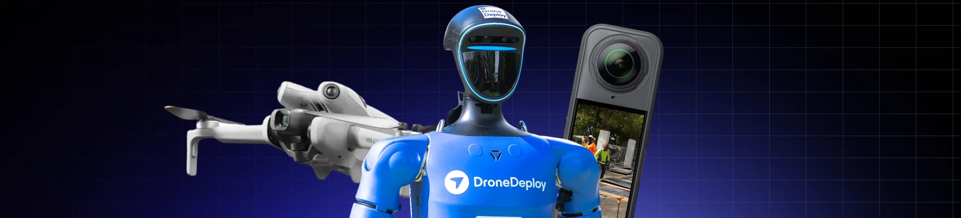
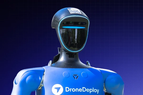
Your first autonomous ground robot (coming 2026)
What this means for you: Get daily site updates without manual capture or coordination. The robot does the work while your team focuses on decisions and action.
––––––––––––––––––––––––––––––––––––––––––––––––––––––––––––––––––––––––––––––––––––––––––––
Embodied AI introduces DroneDeploy's first physical AI agent – a ground robot that captures data autonomously.
The robot navigates safely using a next-generation stack and integrates with Progress AI and Safety AI to deliver daily updates without manual capture. Delivered as robot-as-a-service, DroneDeploy handles setup, operations and maintenance.
This represents the start of fully autonomous operations powered by DroneDeploy's robotics and AI platform.
Watch all Horizons 2025 content
Want to see these products in action? We've made all the content from Horizons 2025 available on DroneDeploy Insider.
Watch the 5-minute product walkthrough →
Access all keynotes and breakout sessions →
Keynote supercuts, breakout recordings and downloadable slide decks are all live. Replay what you missed, share highlights with your team, and bring these updates into your next project.
Have questions about any of these products? Contact our team or explore the resources on DroneDeploy Insider.
FAQ
Related articles


Ready to manage your data from the very start?
Book a quick call to see how DroneDeploy streamlines capture from construction through building ROI.