October 2024 Product Release
.svg)

Quick Summary
DroneDeploy’s latest updates include Safety AI, which automatically detects safety risks during 360 walks with no setup or training, providing OSHA-cited reports and assigning accountability. Interior Offline Deliverables let teams share all project data without internet access, streamlining closeout workflows. On the aerial side, the platform now features faster Mapbox-based map rendering, improved 2D/3D DXF viewing and terrain overlays and expanded flight support for Anzu Raptor and DJI M350/M300 drones through the DroneDeploy Flight app. These upgrades enhance safety, performance and data access across ground and aerial operations.
DroneDeploy Ground
- Safety AI - Every project team wants a safer jobsite. Introducing Safety AI, your team’s newest safety assistant that scans every frame of your walks and automatically identifies potential safety risks with zero touch and zero training. Unbiased, accurate safety monitoring on every walk across all of your projects.
- Interior Offline Deliverable - For those members of the project team that need DroneDeploy project data, DroneDeploy Ground now offers an offline deliverable. There is no longer a need for a connected environment to share project data including all media and drawings.
DroneDeploy Aerial
- Exterior Mapbox Upgrade - The underlying Map Libraries that provide the visual map layer for our platform have been migrated from Leaflet to Mapbox for the exterior explore page to improve performance and visualization for aerial customers.
- DXF File Improvements - View DXF files in 2D or easily reveal 2D DXF overlays in 3D that might be hidden.
- Anzu Raptor Flight Support - Perform all flight types and use Instant RTK, directly from the DroneDeploy Flight app on the Anzu Raptor Remote Controller.
- M350/M300 + P1, H20 and H20T Flight Support - Install the DroneDeploy Flight app on the RC Plus controller and enjoy support for a wide range of missions, from mapping to video capture.
For a list of all October releases, check out the release notes.
DroneDeploy Ground
Safety AI
DroneDeploy is transforming safety risk prevention with Safety AI. Utilizing AI trained on real customer environments, Safety AI detects 95% or visible risks while continuing the same 360 walkthroughs you’re already doing. Zero Training, Zero Touch. Designated personnel receive comprehensive safety reports identifying potential risks by type, severity, location and citing the applicable OSHA standard. As a premium add-on to DroneDeploy Ground, Safety AI lets responsible safety personnel assign detected risks to accountable stakeholders and track resolution of the risk. Help your workers go home safely every day with Safety AI.
For more information about Safety AI, visit the Safety AI webpage.
Interior Offline Deliverable
For those members of the project team that need DroneDeploy project data, DroneDeploy Ground now offers an offline deliverable option. There is no longer a need for a connected environment to share project data including all media and drawings. Sharing DroneDeploy project data with owners for project closeout just became easier.

DroneDeploy Aerial
Exterior Mapbox Upgrade: Faster, Smoother, Better
We’ve migrated the underlying map libraries from Leaflet to Mapbox for the exterior explore page, improving performance and enhancing the visual map layer of our platform. This change is a major upgrade that will elevate your mapping experience across the board.
DXF File Improvements
2D DXF File Viewing
DXF files are a staple in the architecture, engineering, and construction (AEC) industries, typically used to share detailed design plans. Until now, you could only view these files in 3D mode. With this update, you can now view DXF files in both 2D and 3D modes, providing more flexibility and enhancing the ways you can interact with your data.
DXF Visualization on 3D Terrain
Viewing 2D DXF overlays on complex 3D models can be tricky—until now! With our new Clamp DXF Layers feature, you can easily reveal 2D DXF overlays that might be hidden by 3D aerial models. This feature is perfect for project managers, VDC managers, and superintendents who need to visualize lot lines, underground utilities, or road centerlines on undulating terrain.
Anzu Raptor Flight Support
We’re excited to announce full flight support for the Anzu Raptor drone, giving you the most advanced tools for secure, accurate, and efficient data capture. If you're concerned about DJI security or just looking for alternatives, the Anzu Raptor offers similar specs at a competitive price point. You can now perform all flight types and use Instant RTK, directly from the DroneDeploy Flight app on the Anzu Raptor Remote Controller.
%25201.avif)
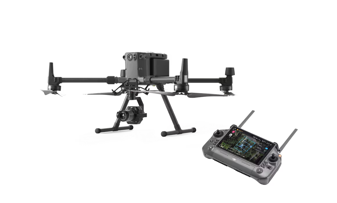
M350/M300 + P1, H20 and H20T Flight Support
DroneDeploy now supports all mission types for DJI M350 and M300 drones equipped with P1, H20, and H20T cameras. Whether you’re capturing high-accuracy maps with the P1 or performing inspections with the H20 and H20T, we’ve got you covered. Pilots can install the DroneDeploy Flight app on the RC Plus controller and enjoy support for a wide range of missions, from mapping to video capture.
.png)
FAQ
Related articles


Ready to manage your data from the very start?
Book a quick call to see how DroneDeploy streamlines capture from construction through building ROI.