10 Tips for Making Your First Map with DroneDeploy
.svg)

Quick Summary
So, you’ve purchased your DJI drone, downloaded the DroneDeploy mobile app, and now you’re ready to make your very first drone map. Before you get out there and fly a field or site, we want to make sure you’re set up for success.
Whether you’re a specialist who wants to use drones to increase the efficiency on the job, or a drone service provider looking to expand the range of your business, this post will help you improve the quality of your drone map with some best practices to follow during your first flight.
Here are our top 10 tips for success on your first flight with DroneDeploy:
Fly High
During your first flight, consider flying at an altitude between 300–400 feet above ground level (AGL). Flying at a higher altitude gives the camera more land area to cover in a single image. This translates to greater chances of capturing any unique features that are present in multiple photos. This is important during the processing stage (learn more about why here) and also helps when mapping any areas with homogeneous imagery, such as tree canopies or agricultural areas.
Flying higher is the single most powerful way to improve the quality of a processed map. Remember: Altitude is your friend.
Fly on an Overcast Day (or When the Sun is Directly Overhead)
It’s always important to check the weather before you fly. But don’t get dismayed if you see an overcast day in the forecast. Flying when the sky is overcast allows you use the clouds as a light diffuser by filtering the natural sunlight. Light diffusers are common in professional photography because they provide soft, even lighting on your subject. And you can mimic this technique with drone mapping on an overcast day. Filtered light can greatly reduce shadows, blurriness, and glare from reflective surfaces — all of which will improve your map or 3D model after it’s been processed.
We also recommend trying to fly between the hours of 10 AM-2 PM, when the sun is overhead. This results in less shadows in photographs, which— as we mentioned—helps during processing. You also want to avoid partly cloudy days and high winds, both of which can make it difficult to capture quality images for your maps.
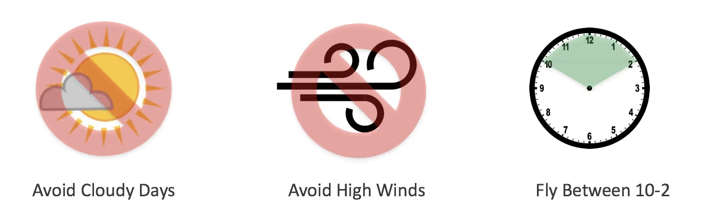
Avoid cloudy and windy conditions, and fly from 10–2 for best results
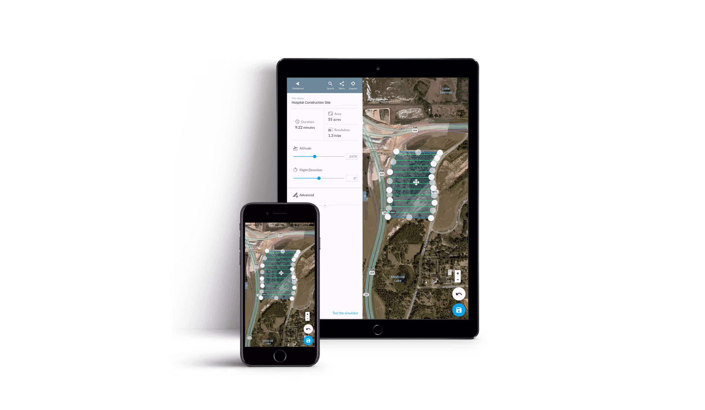
Increase Overlap
Increasing the overlap for a flight is another way to create more matched points across individual images during the stitching process. Overlap refers to the percentage of both sidelap and frontlap. Sidelap is the percentage of overlap between each leg of a flight, while frontlap refers to the percentage of overlap between one image and the next. DroneDeploy’s default overlap is set at 60/70 in order to find a balance between accuracy and large image quantity. Many drone operators adjust the overlap depending on the needs of a particular project, striking a balance dependent on the project’s requirements and desired outputs.

Check (and Doublecheck) Your Camera Settings
The DroneDeploy app is designed to capture camera imagery at its absolute best quality. However, ultimately image quality can be determined by a wide range of factors. So, we always recommend you check the quality of any individual photos captured as the drone is performing the mission flight.
For those who are more experienced with photography, clicking the Automatic Camera Settings toggle button off you can manually adjust your camera settings in the DJI Go App. This allows you to adjust camera settings such as shutter speed, white balance, and ISO manually, which can sometimes lead to crisper, more consistent images for your maps.
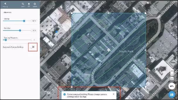
Turn off automatic camera settings to make manually adjustments in the DJI Go app
Learn more about improving the quality of your drone maps by adjusting manual settings in this post.
Update to the Latest DJI Firmware
Before you go out and fly any mission, it’s always important to make sure that your drone hardware is up to date and has the latest firmware installed. Firmware updates are issued for all DJI drones fixes any reported issues and ensures DJI’s products continue to provide information and features to support safe flight. Learn more about updating your drone’s firmware in our Zero to Hero video series. Keep in mind that when you are updating the firmware it’s best to remove the props from the drone beforehand.
Use a Recommended Mobile Device When Flying
While the DroneDeploy flight app works on many iOS and Android devices, some devices are going to provide better performance, user experience, and security. This is because computing power, memory, and other hardware factors play a role in operating DroneDeploy’s software during flight. In general, we recommend newer devices for the best experience. We also provide a list of supported and recommended devices in our support documents.
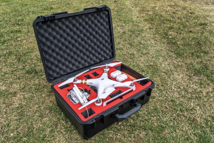
Pack the Right Gear and Inspect it Before Your Flight
Before heading out to the site, you’ll want to be sure you have all the right gear packed — and that it’s in working condition. The last thing you want is to get into the field and realize you left your SD card or connection cable back at home, or in the office. Here are some hardware tips to keep in mind before you go out to make your first map:
- Check the usb cable between your remote and mobile device in advance to make sure it is in good operating condition
- Keep a few backup Micro SD cards in the drone carrying case in the chance you forget to pack one before the mission
- Inspect the drone for any types of cracks between mounting points
- Make sure the props are in good condition and not chipped in any way
- Consider bringing an extra battery (or two) in case you’re in the field longer than expected
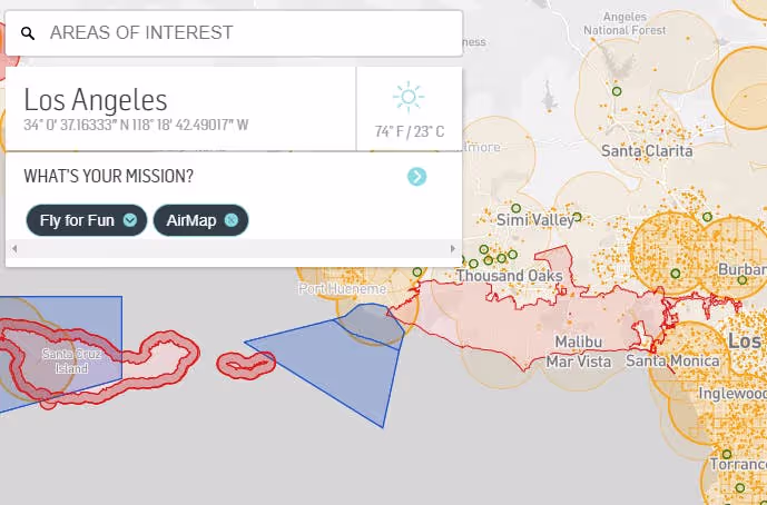
Use AirMap to check airspace before your mission
Leverage Flight Planning Apps in the App Market
There are a host of apps in the DroneDeploy App Market that can help with flight planning and optimization. And they can be easily be installed via the app dashboard on your mobile device or desktop.
We always recommend checking airspace before you fly with apps like AirMap and Flyte. Make sure that you’re operating in a legal airspace, and no flight restrictions or notices to airmen (NOTAM) are in place. You can also check the FAA website for the latest updates to airspace.
Some of our other top app recommendations can be found here.
Fly in 3D Mode to Make Better Models
While making great 3D models has always been part art and part science, we’re trying hard to automate the process by putting our drone database to good use. That’s why we recently released our new 3D Mode. 3D Mode is currently part of DroneDeploy Labs, where we release some of our newest beta features for testing, and is available under the “Settings” tab in the DroneDeploy dashboard. It’s the go-to place for the latest innovations in drone mapping.
Enable 3D Flight Mode in the Advanced Settings tab during your next 3D mapping mission
In 3D Mode, your drone will fly along the perimeter of your flight plan and take a predefined set of oblique images — photos pointed inwards toward the center of the mapping area — resulting in a better data set for producing 3D models.
Update to the Latest Version of the DroneDeploy Mobile Flight App
Last, but certainly not least, we always recommend flying with the latest version of the DroneDeploy mobile app. We frequently update our app to give you with the best flight experience possible. Our updates also provide support for new hardware, and fix any known issues you might encounter. So, before you head out to the field, check to see if you’ve got the latest version of the app installed by stopping by the iOS App Store or the Android Play Store.
Where to Learn More
If you are new to drones, and especially drone mapping, our Zero to Hero video series is a good place to start. Here, you’ll get advice on everything from unboxing your drone, to engaging in advanced flight planning.
Our support documents cover a wide range of topics for beginners including FAQs, getting started with DroneDeploy, and more.
Remember, if you’re flying commercially you need to get certified by the FAA first. For information on obtaining your Part 107 certification, check out commercial helicopter and drone pilot Ian Smith’s post outlining the process.
Interested in discovering more tools to simplify your workflow? Explore all the apps available to you on the DroneDeploy App Market.
Want to learn more about making good drone maps? Read some of our other blog resources to get a better understanding of the concepts at work, along with best practices:
- Understanding Map Processing and Stitching
- How to Make Better 3D Models
- How to Make More Accurate Maps
- How to Map Large Areas
.png)
FAQ
Related articles


Ready to manage your data from the very start?
Book a quick call to see how DroneDeploy streamlines capture from construction through building ROI.