


What is high accuracy?
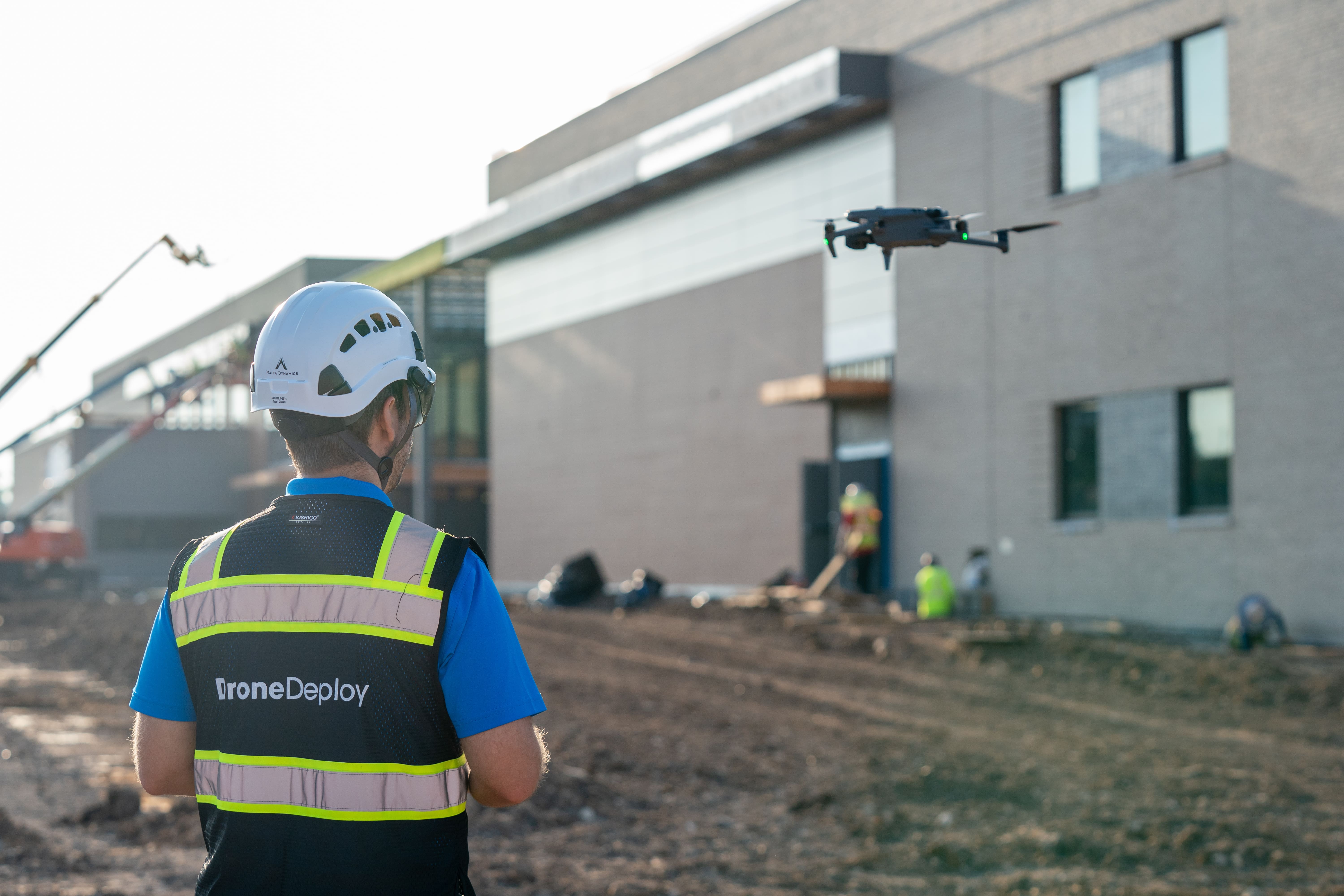
Drones are fast and efficient tools for creating 3D maps or models of job sites using overlapping georeferenced photos. But without accuracy, all you have is beautiful imagery – you miss the opportunity to do deeper data analysis.
Drone photogrammetry that achieves accuracy within an inch unlocks valuable use cases like earthworks measurements, QA/QC analysis and understanding change over time.
Why is it important?
Confidence in map alignment
Improve both relative and accurate map accuracy and spend less time trying to align maps.
As-built deliverables
Align maps with the real-world so you can compare with overlays, BIM and verify completed work.
Clear progress reporting
Ensure consistency for repeated captures so you can accurately report on progress and change over time.
Simplified, yet accurate measurements and analysis
Confidently answer questions like "What's the area of this field?" or "What’s the volume of this stockpile?"
Defining accuracy: relative versus absolute
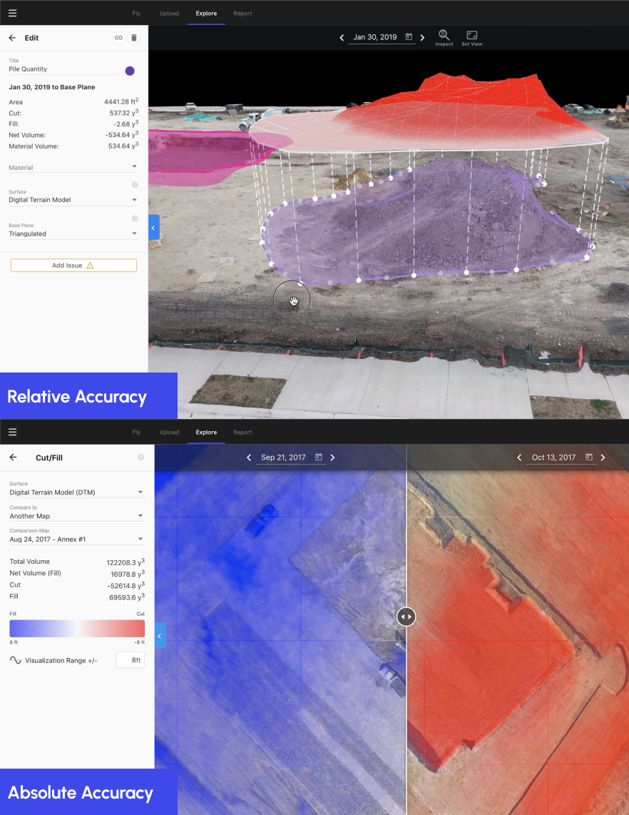
Relative accuracy
Relative accuracy in mapping measures the precision of points in relation to each other, such as the distance between two embeds on a job site. It allows for the focus on the map's scale, shape, and size, without the need to consider its global positioning. Errors are usually expressed as a percentage of the actual values, independent of their precise real-world locations.
Absolute accuracy
Absolute accuracy, also known as global or positional accuracy, is about the precise real-world positioning of a map compared to its actual coordinates. This is crucial when evaluating specific points, like verifying a final grade elevation, tracking changes over time in earthworks, comparing with other georeferenced data, or conducting surveys and engineering workflows. Errors are typically quantified as X, Y, Z discrepancies measured in feet or meters.
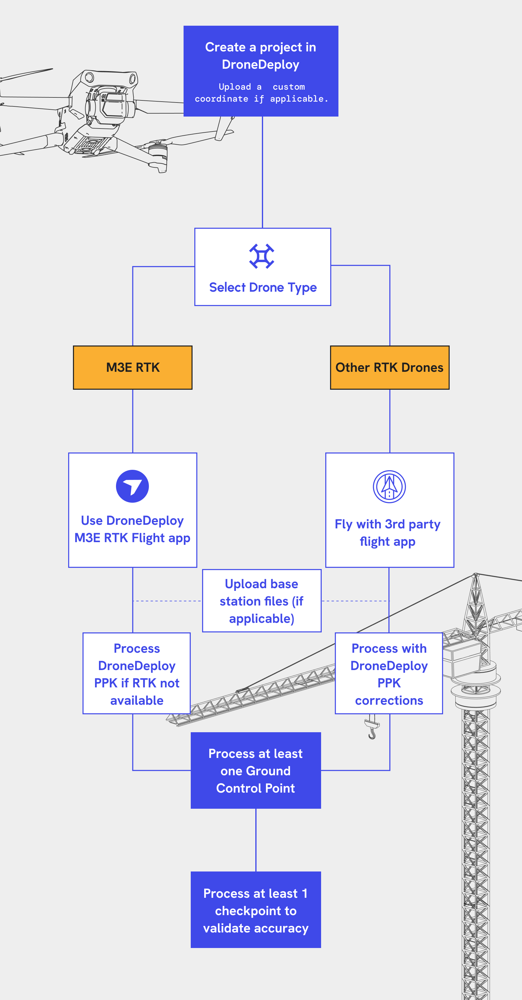
Defining accuracy: RTK, PPK and GCPs
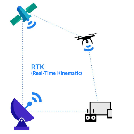
Real-Time Kinematic (RTK) is a GPS correction method enabling drones to receive real-time location data corrections. This technology reduces the need for numerous Ground Control Points (GCPs) in surveying to achieve accuracy.
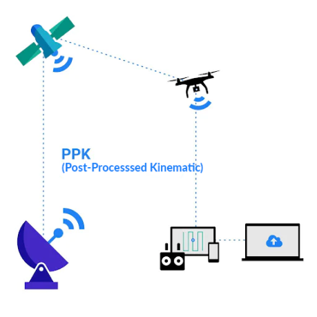
Post Processed Kinematic (PPK) is a GPS correction technology similar to RTK. It differs primarily in updating geotagged location data after image capture by the drone, hence the term "post-processed."
Ground Control Points (GCPs) are the most reliable method for achieving high absolute map accuracy. These are precisely measured known positions on a job site that anchor the map, much like push pins securing a poster to a wall.
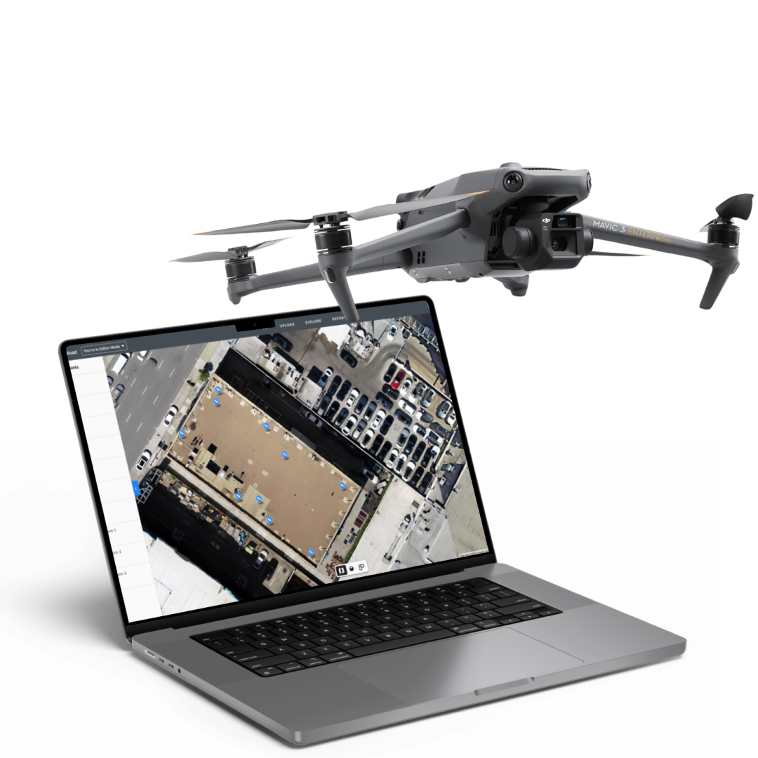
How to create high accuracy maps
What do you need to achieve high accuracy?
Hardware
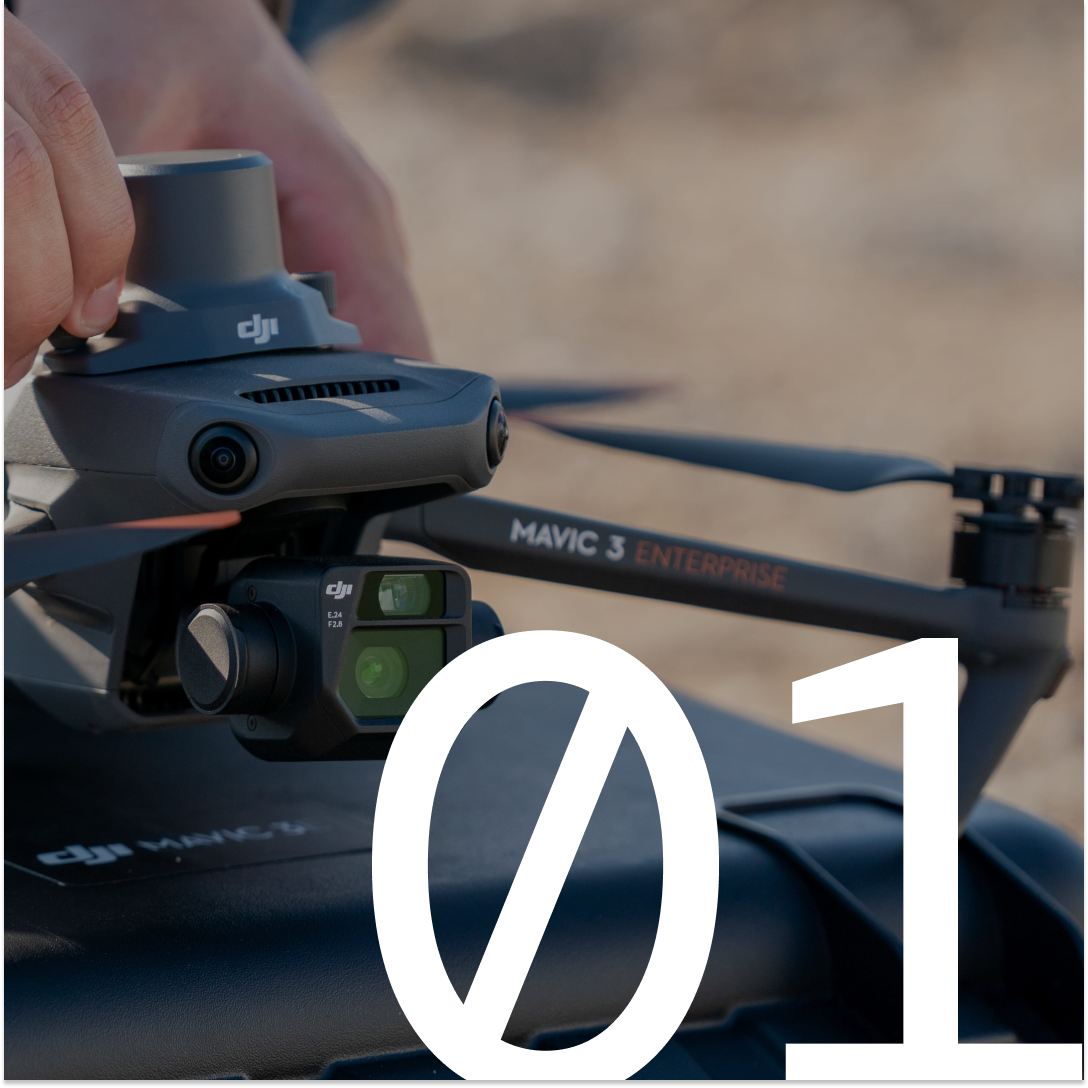
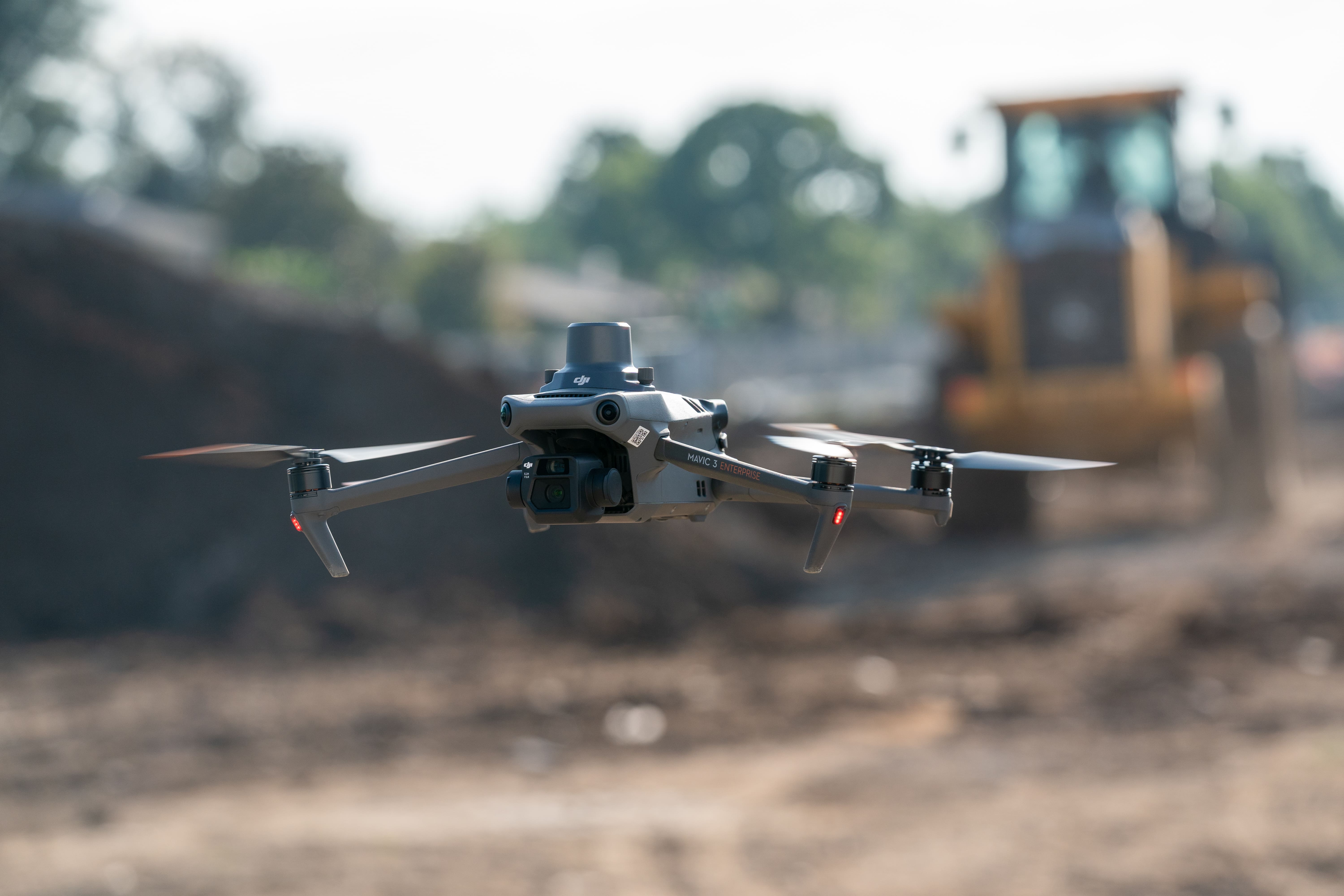
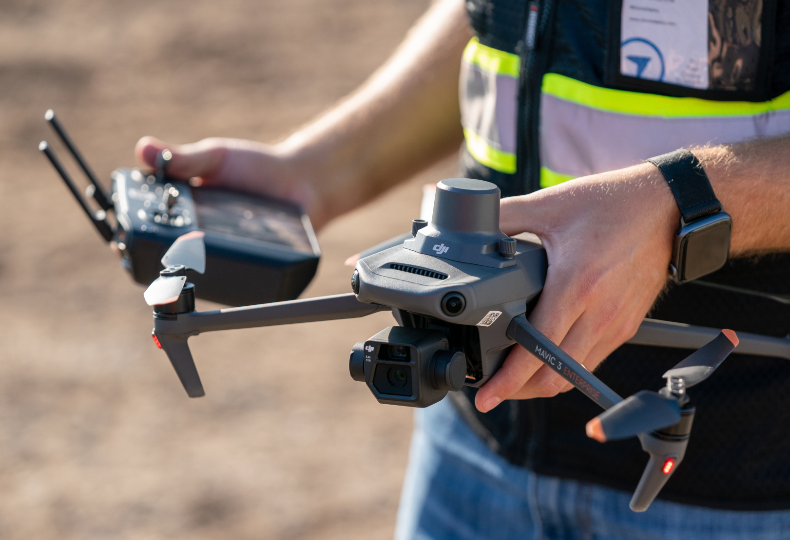
(1) Supported RTK drone
(1) Survey grade equipment to measure marked points on the ground visible from the air.
Key software functionality
Flight planning and autonomous flight control
Processing engine including GCP, RTK/PPK capabilities
Analysis functionality to support key workflows
Surveys
Outputs: Thousands of points
Time to collect: 1-2 days
Processing time: 1-2 weeks
Outputs: Millions of points
Time to collect: 1–3 hours
Processing time: 3–4 hours
Outputs: Millions of points
Time to collect: 1–3 hours
Processing time: 3–4 hours
Ground control points (GCPs)
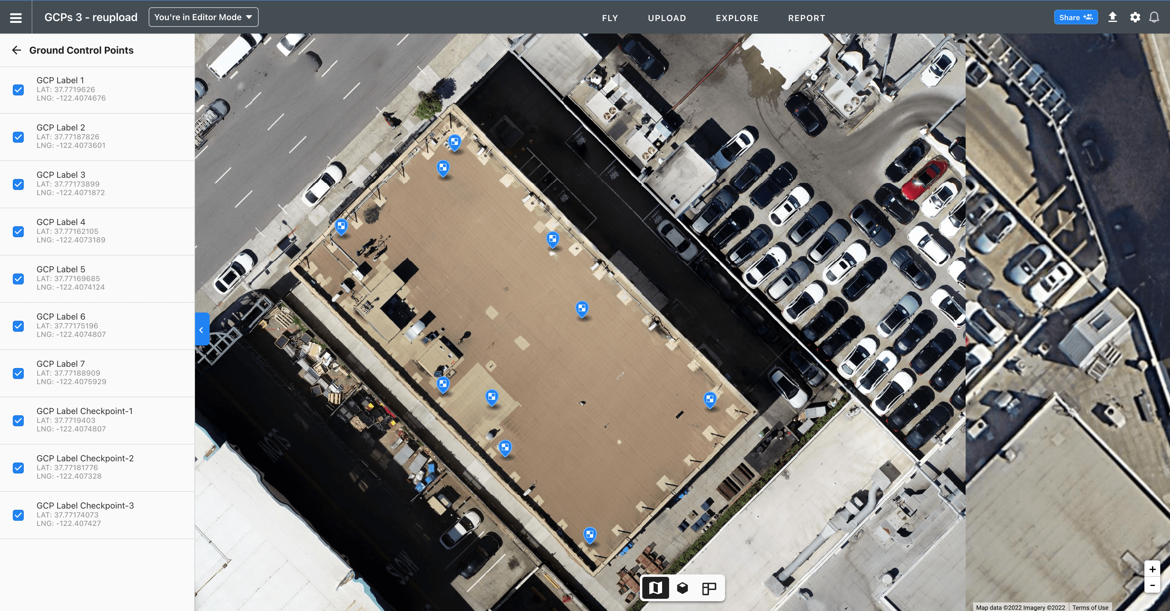
What are they?
Known points on the ground, measured with survey equipment, that are used to enhance the absolute accuracy of your map.
GCP golden rules for best accuracy
The entire perimeter of your job should be enclosed by GCPs. Distribute as evenly as possible.
Give GCPs a 50 foot buffer away from the flight plan edges, buildings, trees or other tall equipment.
At minimum, 1 GCP is required for RTK maps
Aim for 1 GCP for every 60 images for standard GPS drones. Aim for 1 GCP every 200 images for RTK drones.
Workflow spotlight
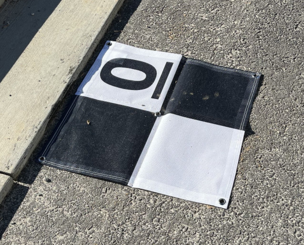
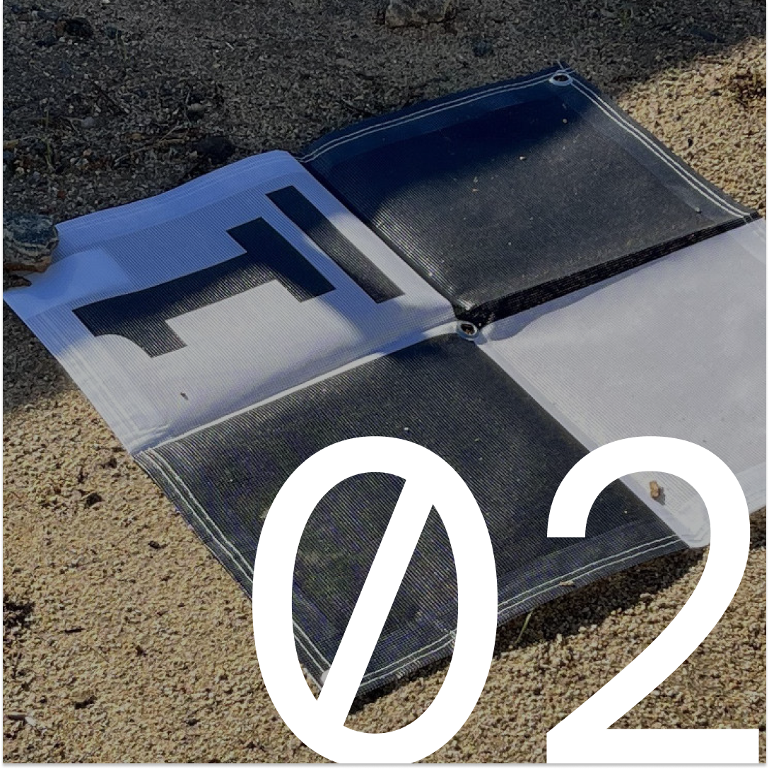
What makes a good GCP marker?
01: Center of GCP is specific and clear.
02: GCP is surface-level object secured or painted on flat, hard ground away from nearby obstacles.
03: Typically at least 2’ x 2’, so it’s clear to see from the air and easy to tag.
04: Ideally can remain in positions for 6 - 12 months (include in logistics plans)
High-accuracy workflow
Additional workflow tips
Other RTK drones include: M300/350, P4P RTK, M30 RTK, DJI Dock 1 and 2, Autel RTK, Wingtra and others.
To ensure PPK processing, make sure the flight is at least 10 minutes long, and to include the .MRK and .OBS from the drone.
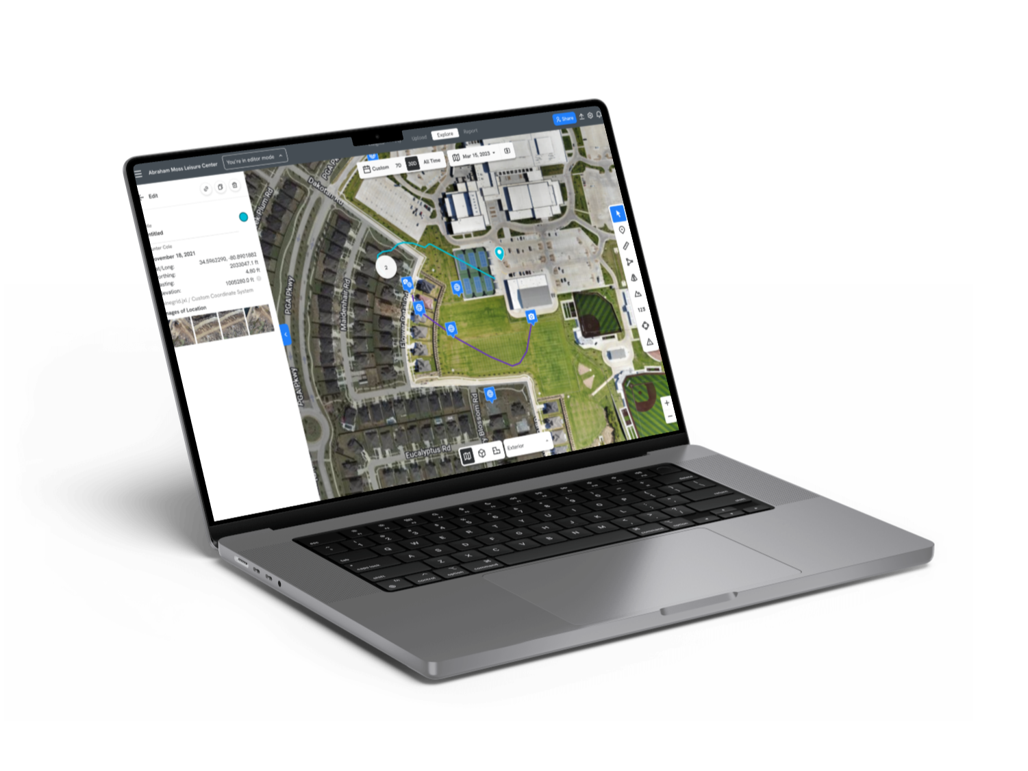
Whatever coordinate system you use, DroneDeploy supports
Does your project use a custom (sometimes called local) coordinate system unique to the job site? If so, you'll likely want your maps, annotations, imports, and exports to be speaking that language.
To create a custom coordinate system for your site, simply upload a Trimble JXL, Leica LOK, or Topcon GC3 file to define your custom system. Then your project will be all set to work in your projects' world.
Feature pro-tip:
Custom coordinates
What are they?
Save time defining your custom coordinate reference system (“CRS”) in DroneDeploy by uploading a Trimble calibration file. Once uploaded, Location Annotations, Imports and Exports will use your custom grid for a simplified comparison to project plan data.To create a new custom-CRS for your site, simply upload a Trimble .JXL calibration file when you create your project or in the project’s settings.
Easily upload GCPs
Once you have a Project CRS established by a calibration file, you can also upload GCPs in custom coordinates only, saving survey collection time and formatting pains.
DroneDeploy high accuracy checklist
Instant RTK
Drag-and-drop PPK
Custom coordinates
Easy site collaboration
Single-GCP workflow
RTK data-on-demand
3D contours
Cut/fill comparison
Terrain edit
New elevation profiles
ML DTMs
3D DXF & IFC import
DroneDeploy RTK and PPK workflows
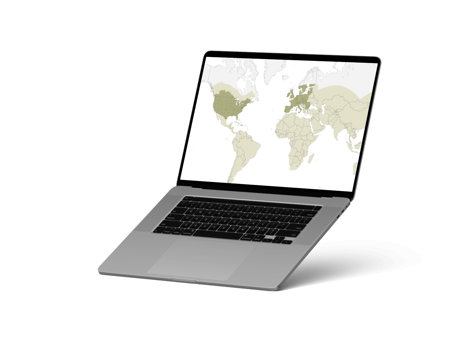
RTK network coverage (CORs)
RTK enhances satellite-based positioning accuracy. It relies on a reference station or network (like a CORs network) for precise geotags during flight, accurately locating the drone. Combining RTK drones with Ground Control Points (GCPs) is recommended for optimal map accuracy.
Benefits of RTK
The benefits of RTK drones include faster, on-demand surveys, improved map survey accuracy, and more frequent high-accuracy data collection. They perform best in open areas with few obstacles (which can weaken the connection to the base station, potentially leading to inaccurate data).
What else you need to know
DroneDeploy includes easy network RTK corrections for free with our M3E RTK Workflow
With DroneDeploy you can instantly connect to the RTK network, no additional credentials needed.
RTK quality depends primarily on...
Make a flight plan in DroneDeploy and we’ll let you know if you’re close enough to a base station for good results.
Site proximity to one of our RTK network partner base stations
Internet signal strength
%201.png)
Confused about high-accuracy mapping?
Let us fly for you!
Busy enough already? Let us handle high-accuracy drone mapping for you with DroneDeploy High Accuracy Professional Services. We’ll provide global data collection services for augmenting your existing in-house program or outsourcing drone operations.
Here's what you can expect:
Flight templates tailored to your workflow and needs
Pilots are trained and vetted by DroneDeploy
Drone data delivered on-time and up-to-spec so your team can focus on making decisions
Generate value immediately without needing to stand up a drone program
Drone PPK
The workflow
Fly a drone with any flight app. Active RTK corrections or internet not required. Just the drone flight is needed.
Benefits of PPK
Like RTK, PPK enhances satellite-based drone position accuracy by referencing against known base stations. However, with PPK the corrections process happens after the flight, rather than in real-time. This means you don't need to worry about network signal strength during flight.
What else you need to know
Minimum 15 minute flight time
When you upload the images, be sure to include the .MRK, .OBS files and on the SD card folder
The Smart Uploader will indicate PPK processing will be used
How do I trust my data...?
Either way you fly, you must use checkpoints to measure your map accuracy.
Checkpoints are known points on the ground, measured with survey equipment, that are used to measure the absolute accuracy of your map. Process all GCP maps with at least one checkpoint.
Validate that your checkpoints are within an acceptable error tolerance by looking at the errors using the Processing Report in DroneDeploy.
What level of accuracy can you expect?
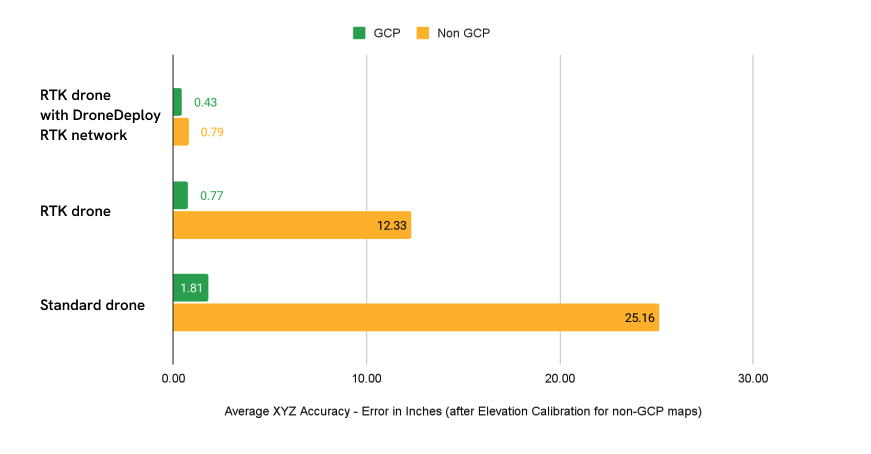
In our testing, you can achieve <.5 inch absolute accuracy when using an RTK Drone with DroneDeploy's RTK Workflow and GCPs. The accuracy that GCPs provide for drone maps is complemented by drone RTK corrections. The closer to a GCP an image is captured, the more confident we can be about
where that photo was taken in reality.
RTK on the drone allows DroneDeploy to stay more confident about where each photo was taken, even photos that are taken relatively far from a GCP. In this case, high accuracy technology (GCPs and RTK) together yielded errors comfortably under an inch.
Measuring the accuracy of the DJI M3E RTK
Creating consistent and accurate maps can be complicated. In our recent whitepaper, we dive into the nitty-gritty details for creating high accuracy drone maps with DJI’s M3E RTK.
High-accuracy use cases
Data alignment
The challenge
To measure and monitor construction progress you need to understand change from week to week, but you can't do that effectively if your maps don't align. If you start with a high accuracy map and add an overlay, that data will be aligned, but if you add a low accuracy map next, your maps won’t be very useful and project teams will quickly get confused.
The solution
Using RTK, PPK, GCPs and checkpoints, you can create accurate maps that align consistently to each other and overlays across your project lifecycle.
ROI
“Determining the correct elevation via DroneDeploy tools was crucial, because if we were off by a few inches, we could’ve had a huge environmental disaster on our hands,”
Wilson Haworth, VDC Manager | Juneau Construction
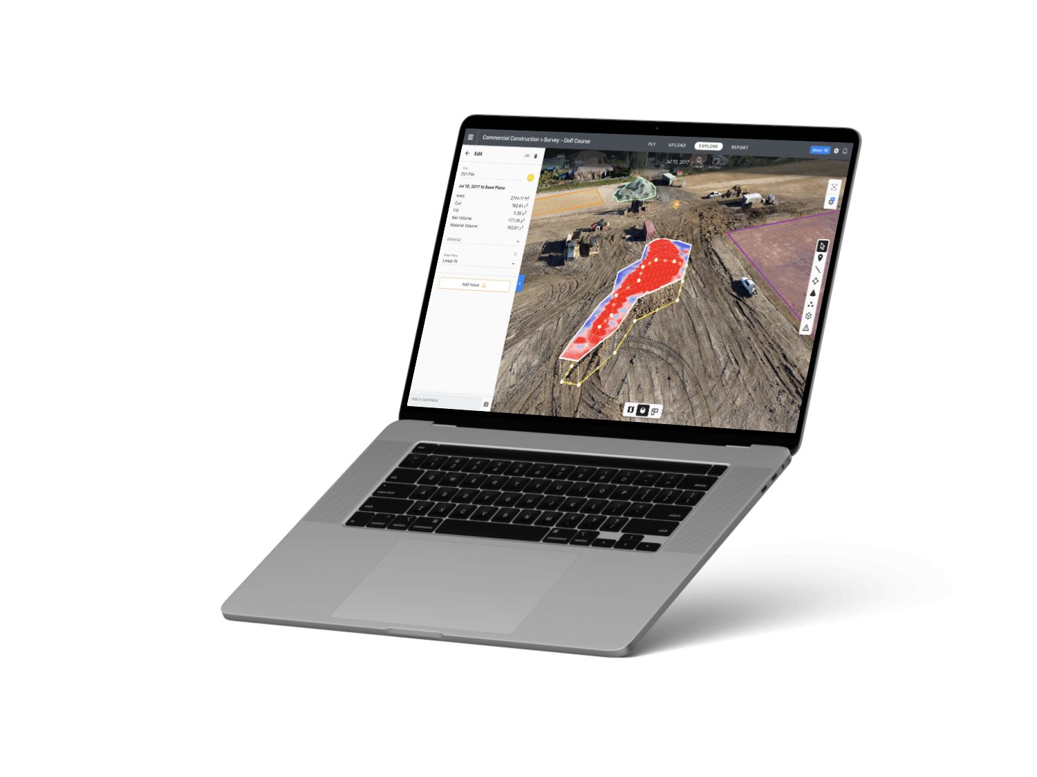
Earthworks cut/fill analysis
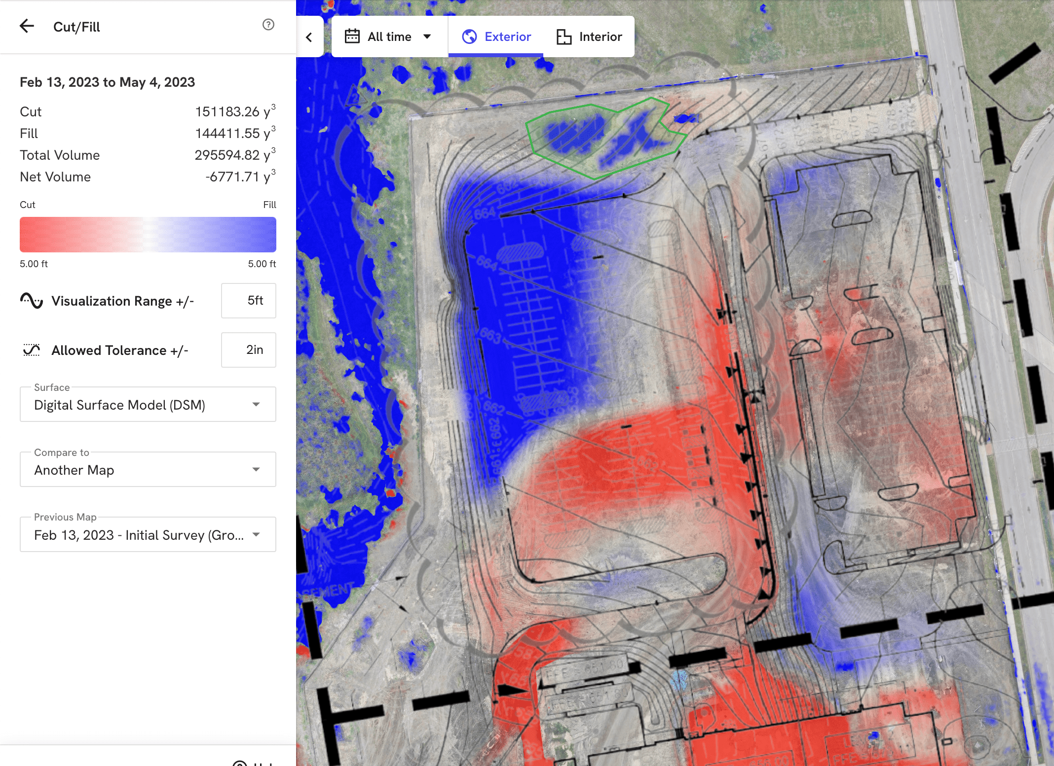
The challenge
You want to perform volumetric comparisons either for an entire site or individual pits or stockpiles, so that you can verify subcontractor work, manage stockpile inventory and stay on schedule. But this requires high-accuracy measurements.
The solution
To effectively compare your project status to a design or previous map, you should check against your benchmark. With high accuracy maps, you are always comparing two surfaces that are georeferenced in a specific location in your cut fill against design or previous work analysis.
ROI
“With DroneDeploy’s Earthworks capabilities, I have the confidence I am providing my engineers with accurate information. I am able to use a map and model to help visualize the site, which makes planning more efficient and accurate. This new way of surveying has saved us hours of time each time we go out and capture data.”
Greg Oetker, Sr. UAS Pilot/Field Project Representative | Carter
Feature pro-tip:
Cut/fill comparison
The Cut/Fill Layer in DroneDeploy streamlines earthworks tracking by comparing elevations across map dates and designs, aiding in timely project management and subcontractor verification. It also automatically uses your previous map for easy visualization of changes in terrain and materials over time.
Compare to design
The challenge
Design files are a core element of any construction project, but they only tell half the story if you can’t compare designs to ground truth. Being off by even a few inches can void the usefulness of comparisons and increase risk.
The solution
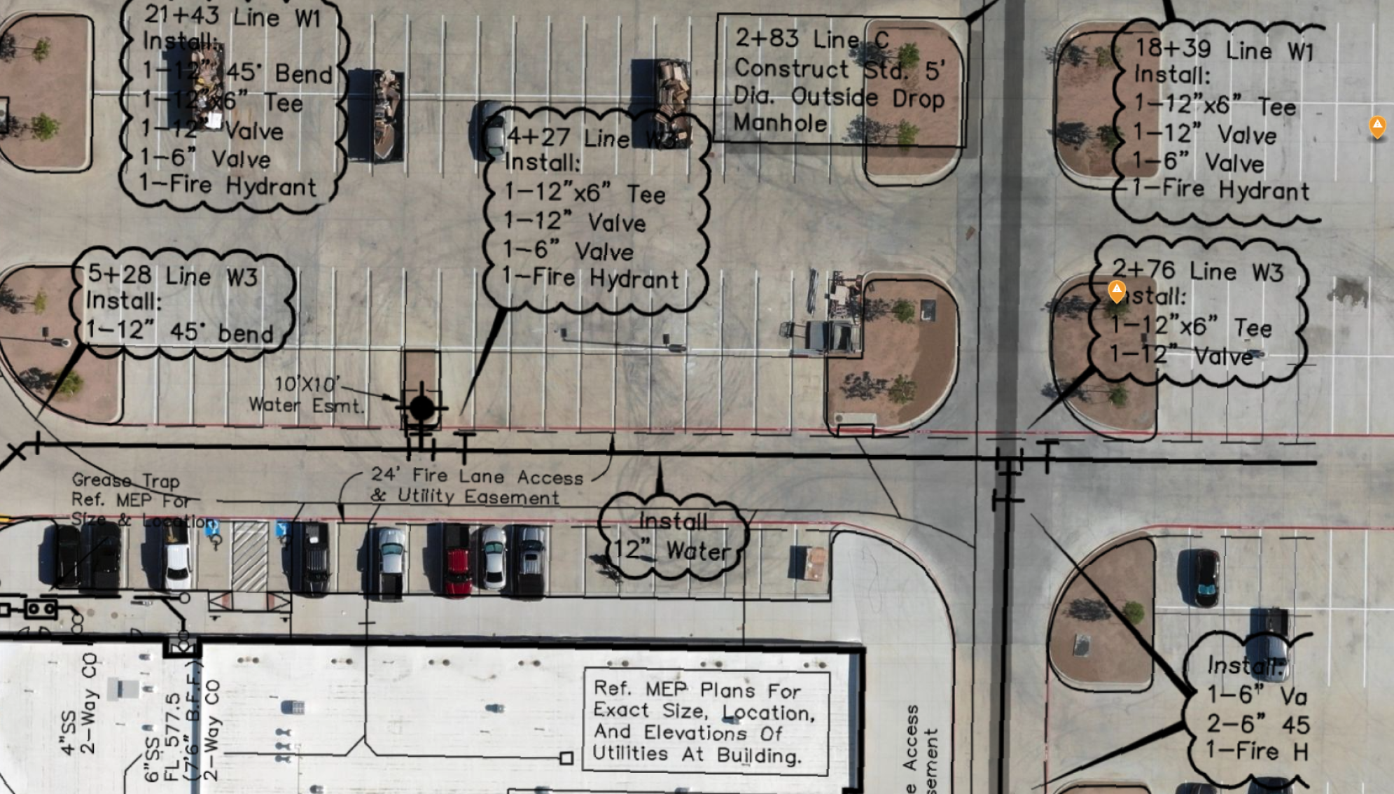
Use accurate georeferenced maps and custom coordinates to make comparisons between design plans, project documents and reality. This means you can confidently compare as-built to design for sleeves, embed, concrete, PT cables, utilities, and more – streamlining project communication and reducing risk.
ROI
“Now, if I need a contractor to be aware of a design change, I simply walk over to him with my tablet, blow up a particular section of overlaid plans and show him exactly what he needs to know.”
Nick Johnson, Project Manager and Owner | Tilt Rock of Texas
%201.png)
Feature pro-tip:
3D DXF and IFC import
3D DXFs
Visualize vector drawings and surface models (such as underground utilities, 3D designs and grading files) layered directly on top of your 3D data in DroneDeploy using 3D DXFs.
3D IFCs
You can also import 3D IFC visualization directly from Revit, Bentley or Tekla into DroneDeploy. Customers use 3D IFC visualization to such as bringing in structural models to coordinate crew work plans, or confirming that slab on grade elements are installed correctly.
How does it help?
Seeing 3D surface models and linework alongside 3D aerial data helps avoid utility strikes, visualize design intent and compare as-built reality to your plans. All in a digital location that’s easily accessible to your entire project team.
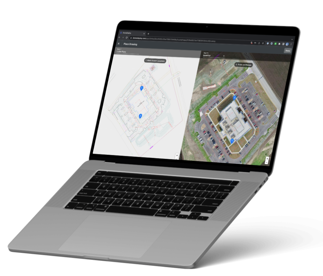
Export to other tools and integrations
The challenge
To validate that your project is progressing in compliance with your design files, you want to align your CAD drawing to your 3D model in DroneDeploy so that you can compare real life to plan. Without absolute accurate positions, the CAD drawing and 3D model won’t line up.
The solution
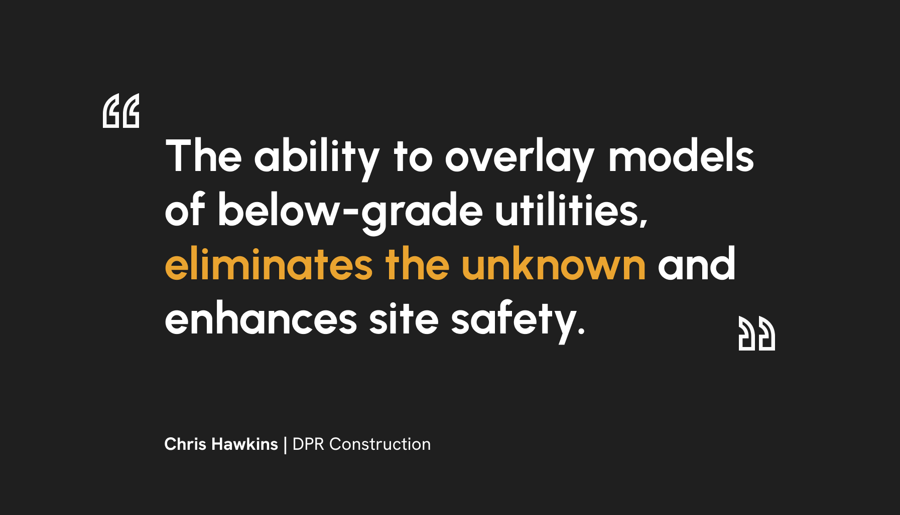
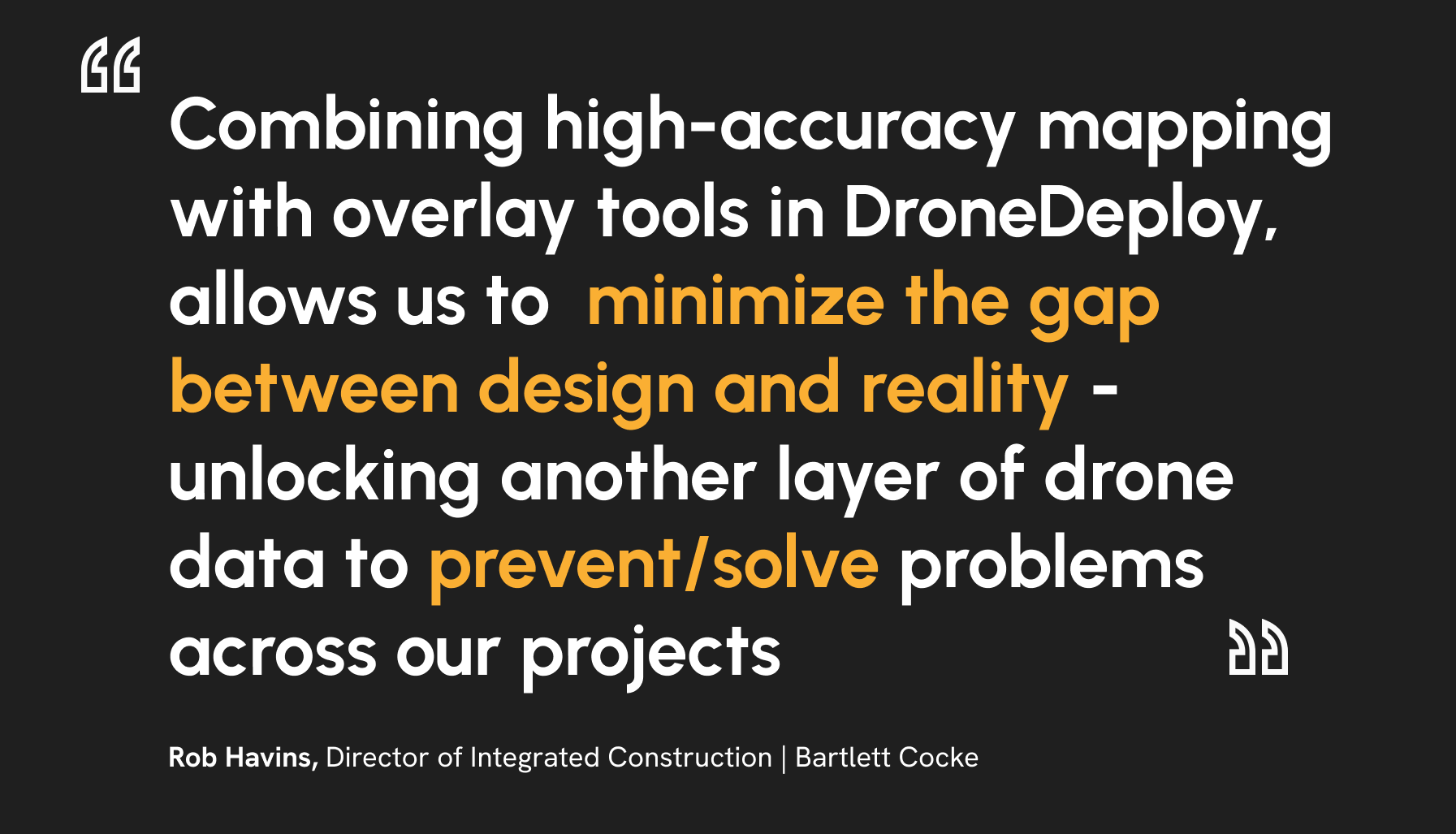
With a high-accuracy map in DroneDeploy, you can confirm absolute accuracy in the coordinate system of your project and import CAD files to visualize underground utilities within the context of real-time site conditions. By having 3D model overlays, your team can stay on track, avoid utility strikes and enhance site safety.
ROI
By having 3D model overlays, your team can see exactly where utilities are buried and confirm site conditions against plan, helping you find problems before they impact costs and improve site safety.
Feature pro-tip:
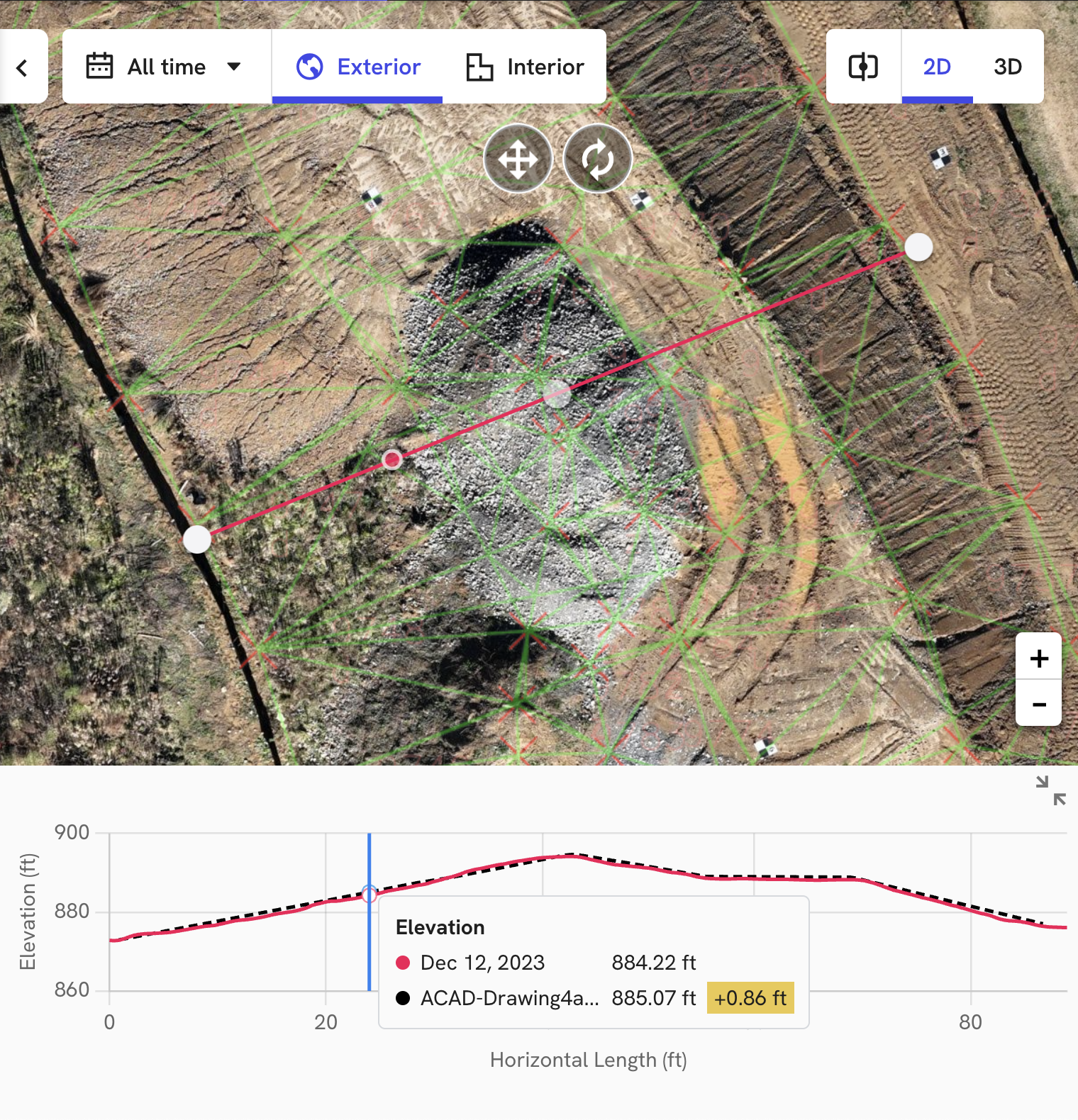
Surface profiles
Surface profiles allow you to easily visualize elevation changes over time by showing simultaneous elevation readings across selected dates on the slider. If a cut/fill design surface is present on the project, its profile will be plotted in the same view.
The delta between elevation values is also reported to help you quickly understand how much work has been done between dates and how much work is left to be done.
To use this feature in DroneDeploy, create a distance annotation as usual, open map comparison and then click the new expand button on the mini-graph to launch “big mode” at the bottom.
As-built documentation
The challenge
Project teams must document site progress to provide regular updates to the project owner. Imagery must be accurately captured as you are building, before it’s covered up.
The solution
High accuracy maps enable teams to efficiently and confidently document site progress at each phase throughout the project lifecycle. Streamline reporting to the owner and eliminate disputes due to incomplete records.
ROI
By leveraging aerial imagery to document as-built conditions, contractors are able to avoid costly schedule delays by understanding discrepancies between the design and what has been built.
Get in touch!


