DroneDeploy
Blog
Learn from industry experts and customers in construction, energy, agriculture, and more. Get product updates and news from the DroneDeploy team.


Thank you! Your submission has been received!
Oops! Something went wrong while submitting the form.

Conservation
Customer Story
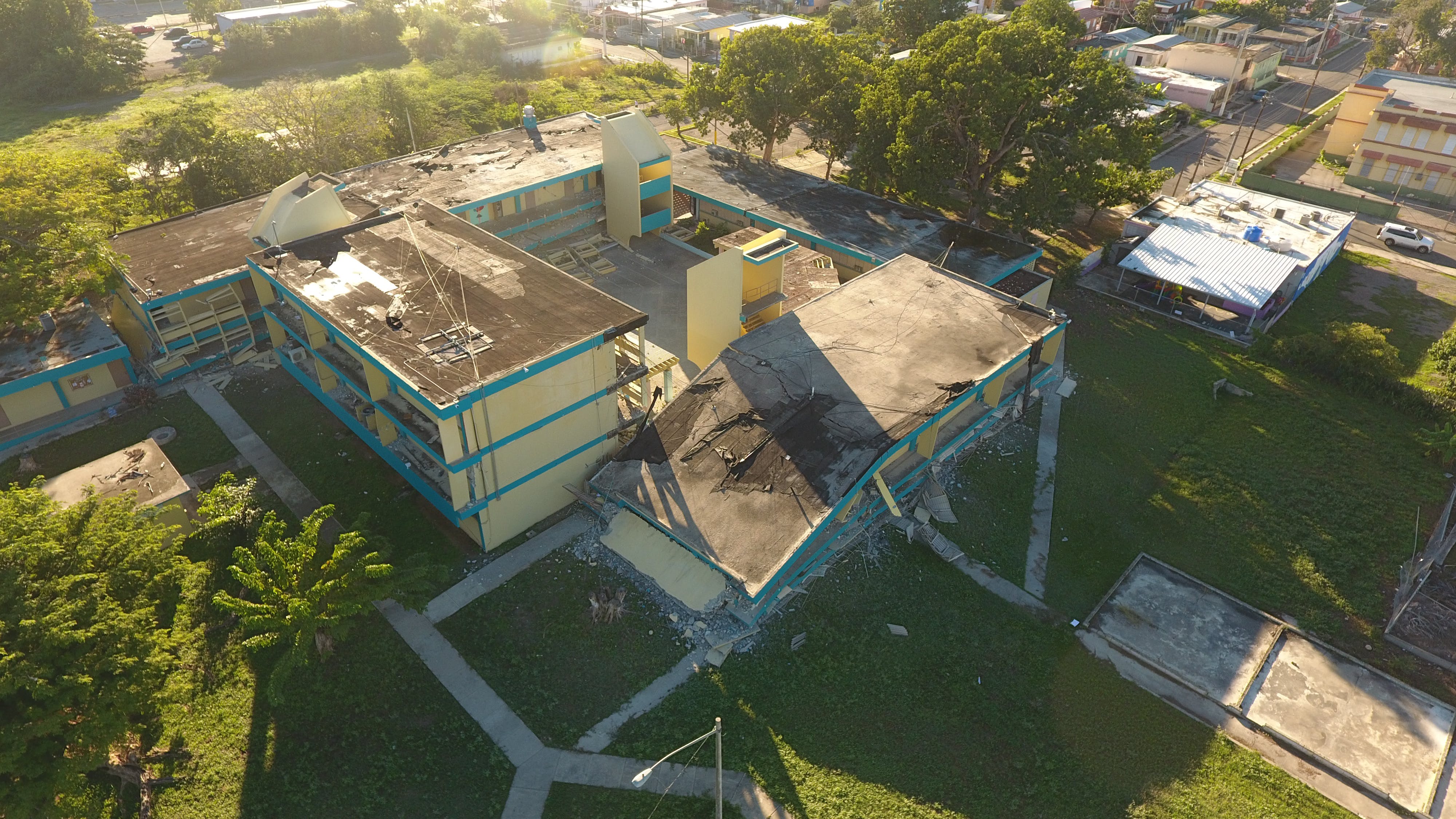
How ICF Leverages Digital Twins in Disaster Recovery
Digital twin technology is simplifying disaster recovery efforts
Read more


