Data centers

See what’s actually happening on every campus

Document your data centers with drones, 360 cameras and robots to build a live, owner-controlled record from preconstruction through O&M.
Used on 3 million sites in 180 countries

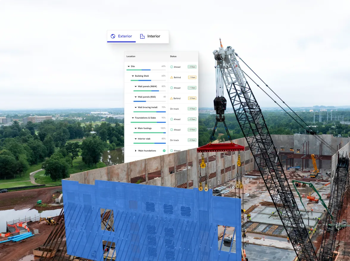
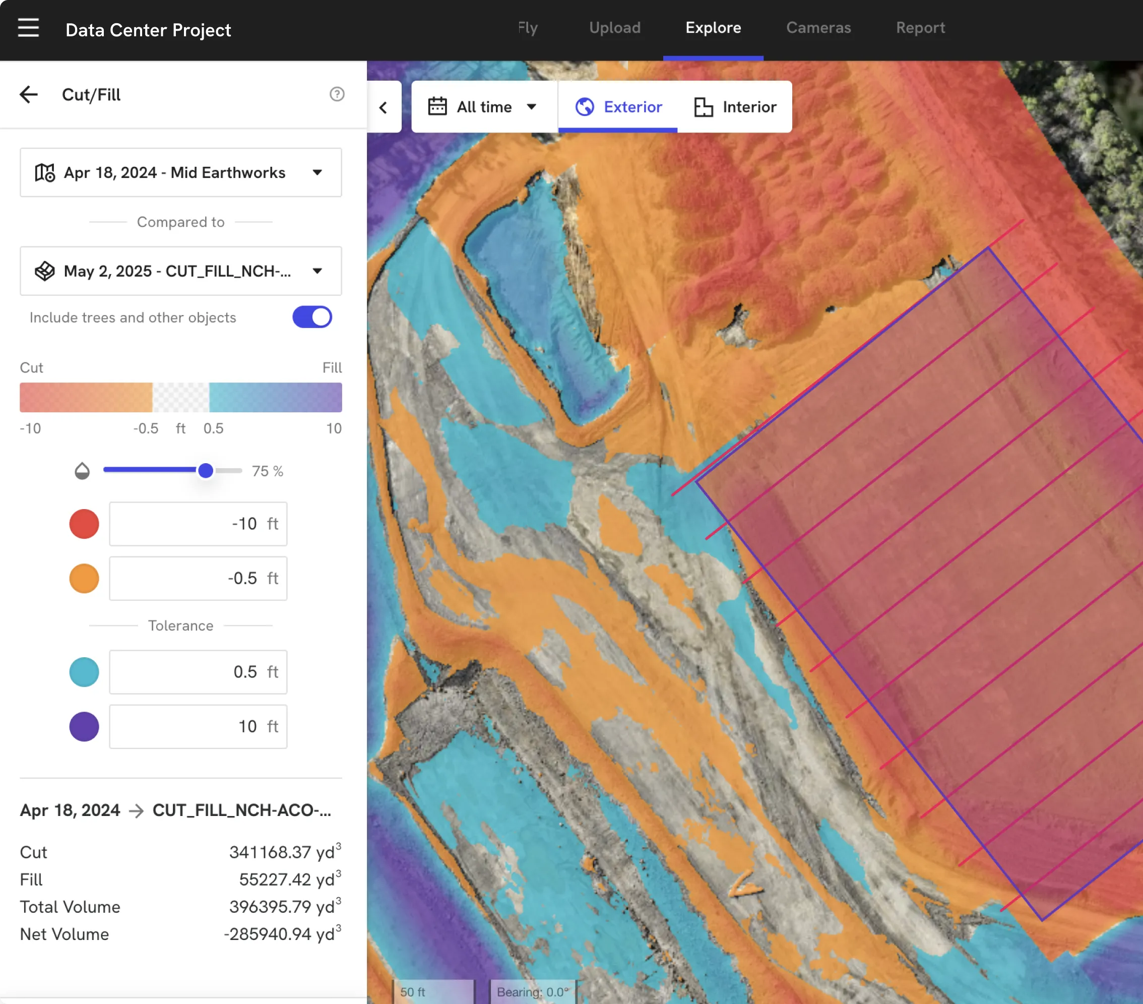
Own your site data across every phase of the project lifecycle.

Documentation & disputes

Capture what matters before it’s buried.
Baseline every new site, then build a time‑stamped record for underground utilities, pads, racks and fit‑out so claims, audits and upgrades rely on proof.

Remote 
visibility

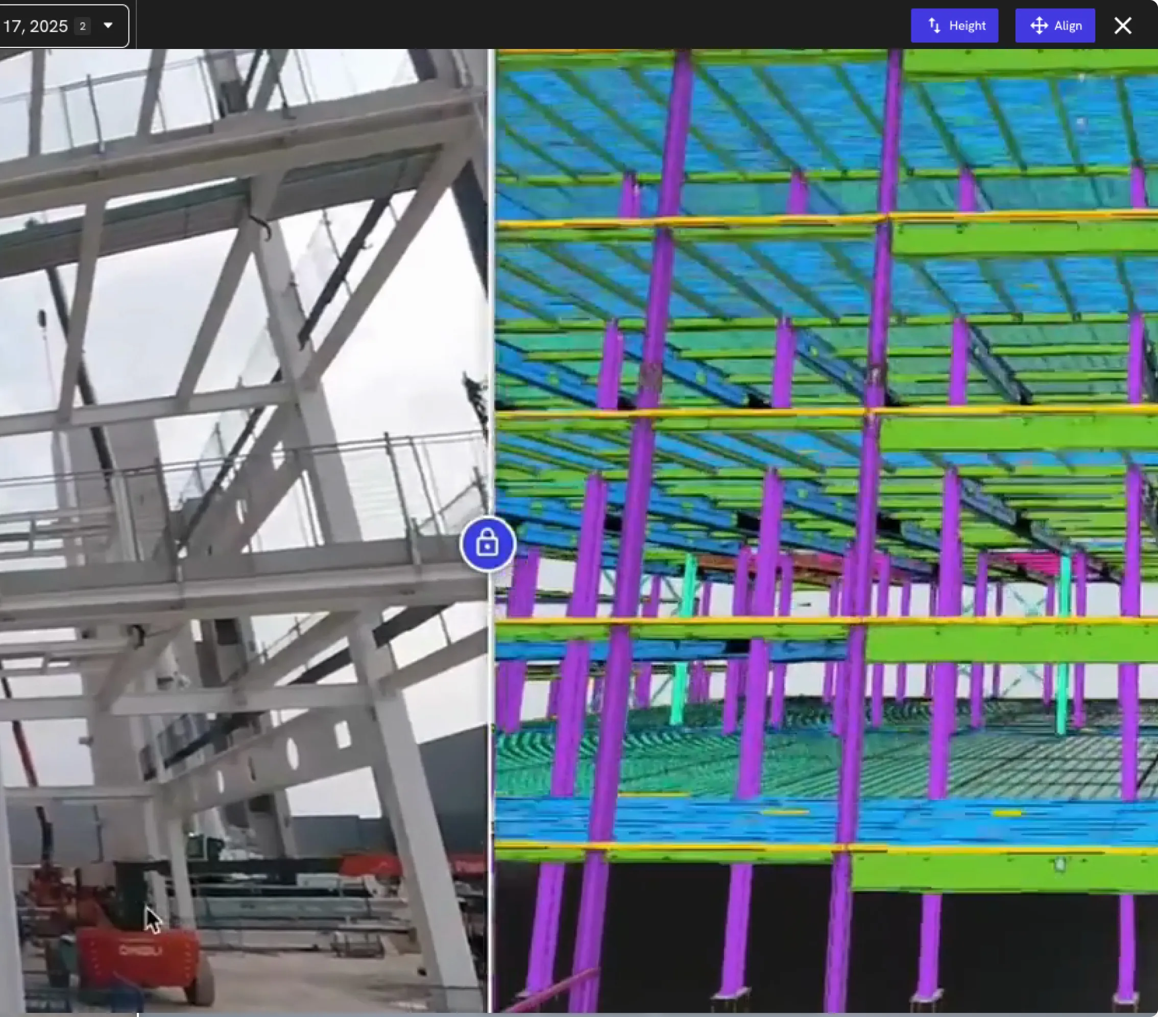
See every hall and corridor without flying to site.
Baseline every new site, then build a time‑stamped record for underground utilities, pads, racks and fit‑out so claims, audits and upgrades rely on proof.

Planning & maintenance

Plan and re‑sequence off what’s actually built.
Baseline every new site, then build a time‑stamped record for underground utilities, pads, racks and fit‑out so claims, audits and upgrades rely on proof.

Capture every phase of the data center lifecycle

DroneDeploy Aerial

Campus‑wide visibility in every flight
Baseline new sites before earthworks begin
Track cut/fill, pads and steel across the entire campus
Compare drone volumes and grades against surveyor data
Overlay design and BIM on live site maps for quick checks
Verify utilities, duct banks and drainage before backfill

DroneDeploy Ground

Autonomous inspections from the ground up
Use robots and 360 cameras to walk galleries, white space and MEP rooms
Compare interior walks against BIM to spot clashes and misses fast
Capture rack, cable tray and containment installs before ceilings close
Track equipment rooms, corridors and risers through every stage of fit‑out
Walk (or drive) once, share with project, controls and operations teams

Need a full feature list and custom quote?

Supported hardware

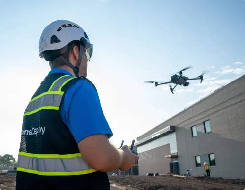
Build your fleet
(or let us do it for you)
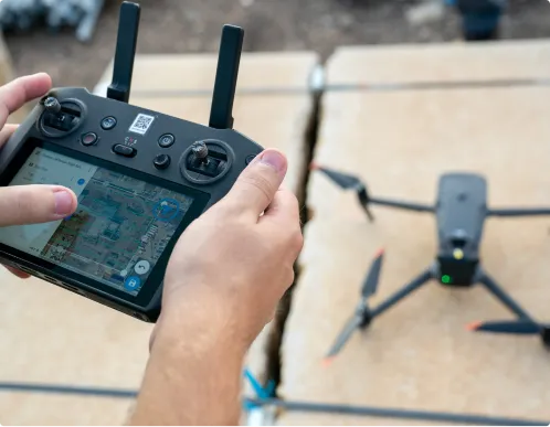
Drones

Capture high‑resolution RGB and thermal data across mega‑campuses with leading enterprise‑grade drones, including RTK/PPK workflows when survey‑grade accuracy is required.
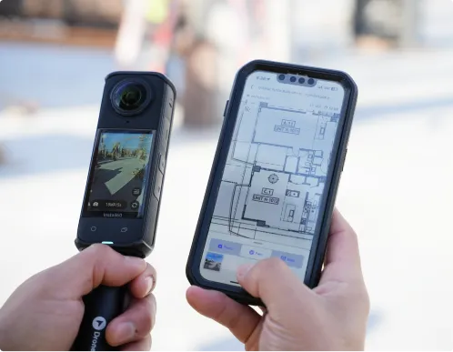
Get the right drone for your campuses

360 cameras

Document galleries, equipment rooms, corridors and roof spaces with fast 360° walks that map directly to your floor plans.
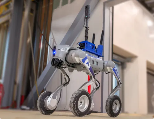
Order a 360 camera kit

Docks and robots

Deploy docked drones and ground robots to run repeatable routes around critical buildings and yards, keeping your visual record current without constant site walks.

Get a robot on your site

Data on demand

Need the data but don't have pilots or hardware yet? Use our services network to capture aerial and 360 coverage at the cadence you need, with processed maps and walks delivered straight into your DroneDeploy account.

Get your data delivered to you
Integrations

Don't just collect data – connect it.

See all 80+ integrations

Don’t operate off opinions.

Make decisions based on what’s actually happening on every project.
Drive ROI
Document history
Eliminate manual walking
Unified site data
Daily site alignment
Deliver on time
"With DroneDeploy, we’re blowing way past 5x savings."
Matt Craske
Former Head
of Global Program
Controls, Google
See how
"DroneDeploy provides a time capsule to go back and see what the site looked like months ago."
Matt Craske
Former Head
of Global Program
Controls, Google
See how
"We’re overlaying 3D below-ground models on DroneDeploy to see exactly where utilities are, which is improving our safety."
Peter Hewitt
Engineering Leader
See how
"Drone flights, ground walks, scans and time-lapses – they are all being brought together within DroneDeploy."
Peter Hewitt
Engineering Leader
See how
"Reviewing our data center logistics plan every morning and overlaying it on a drone flight ensures 1,200 people are working from the same up-to-date map."
Brady Hickman
VDC Manager
See how
"For a $10B data center investment across 2,200 acres, owners demand speed. There is no other way to build without automated reality capture."
Brett Kostial
Senior VDC Manager, Global Critical Facilities
See how
Frequently asked questions

Is DroneDeploy the right fit for your data center programs?

Our GCs already use reality capture. Why do we need our own?

That’s a strength, not a conflict. Standardizing on your own DroneDeploy org lets you aggregate GC capture into a single, owner‑controlled record, so everyone is looking at the same source of truth while you still benefit from their existing workflows.

We already have cameras and video on site. How is this different?

Cameras and body cams capture moments. DroneDeploy turns those visuals and drone flights into structured, searchable, time‑stamped records you can use for portfolio views, progress, claims and audits.

Is this only for hyperscale greenfield builds?

No. Teams use DroneDeploy for greenfield campuses, expansions, retrofits and decommissions – anywhere scope, risk and complexity demand clear, shared visuals.

Do we need in‑house pilots or robotics experts to start?

You don’t. Many data center owners start with services flights and a small internal footprint, then scale into standard aerial and ground workflows as value is proven.

Can DroneDeploy meet our security and compliance requirements?

Yes. Customers use DroneDeploy as a central platform for flight operations and data because it offers encrypted data at rest and in transit, role‑based permissions, and enterprise‑grade controls including SOC 2 and ISO 27001 certifications.

How does this work across multiple campuses globally?

DroneDeploy standardizes capture and data across sites, so maps and 360 walks roll up into portfolio, GIS and BI views for executives – without flying to every campus.

How does this help project controls and program management?

Reality capture becomes the starting point for status and progress – a time‑stamped “time capsule” you can reference when reconciling cost, schedule, risk and change.

Can we use this data for audits, disputes and lessons learned?

Yes. You can scroll back through captures – week by week or phase by phase – to see exactly what was on site, where and when, instead of reconciling viewpoints.

How does this fit with our BIM, CDE and reporting stack?

DroneDeploy acts as the visual layer. Maps, meshes and 360 walks link into your BIM, CDE, GIS and BI tools so executives, project teams and operators all point at the same truth.

DroneDeploy Insider

Watch how data center teams are doing it

Discover use cases. Watch virtual events. Download playbooks. And get to know our team through our content.

Start streaming

Getting started is simple. Request a demo today.

Book a demo