DroneDeploy Unveils Agentic AI and Robotics Products at Horizons 2025
.svg)
Quick Summary
DroneDeploy unveiled a major platform expansion at Horizons 2025, launching three AI agents (Progress, Safety, and Inspection AI) and announcing 2026 beta deployments of autonomous ground robots. Upgrades to aerial and ground tools now deliver survey-grade accuracy, LiDAR-based 3D scanning, and photorealistic site models, driving faster and smarter decisions across construction and industrial sectors.
Reality capture leader delivers agentic AI suite, major accuracy and 3D upgrades.
- Three AI agents now operational: Safety AI to detect safety hazards, Progress AI to track progress and Inspection AI for predictive asset maintenance.
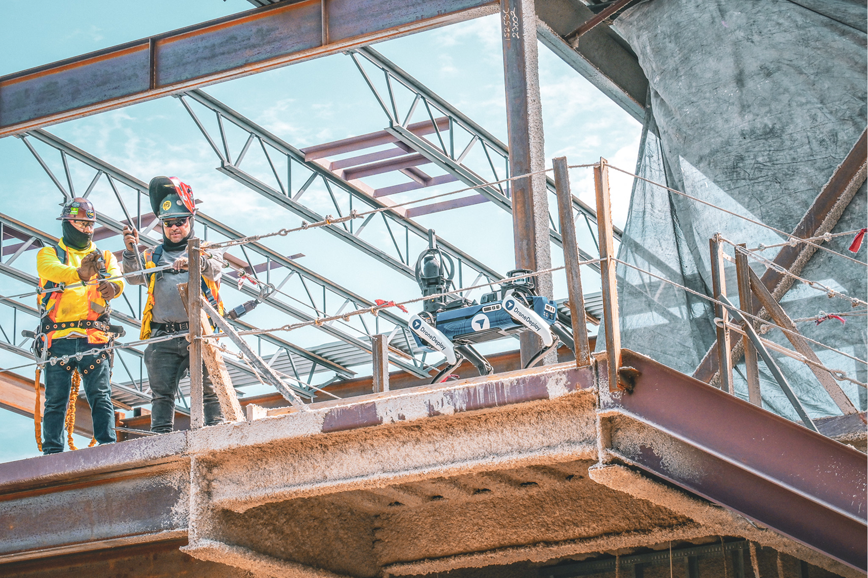
- Robotics expansion accelerates with embodied AI ground robots entering beta in 2026, powered by visual intelligence trained from data captured across 3 million sites.
- Unified platform enhancements deliver verified survey-grade accuracy, 3D scanning with mobile device LiDAR, automated earthworks analysis and Gaussian Splats.
San Francisco, CA – October 28, 2025 – DroneDeploy, the leading reality capture platform used on over 3 million sites worldwide, unveiled a suite of product innovations at the Horizons 2025 user conference. These solutions deliver on the vision of a unified platform where robotic automation, AI agents and decision-grade data work together to transform operations in critical industries.
DroneDeploy is solving the three fundamental challenges every field team faces: capturing data consistently, analyzing it intelligently and ensuring it's accurate enough to drive real decisions.
"The future of construction and industrial operations isn't some distant promise, it's being built right now on jobsites and in facilities," said Mike Winn, CEO and co-founder of DroneDeploy. "We're meeting customers where they are, whether that's enhancing the accuracy and automation of their current workflows or preparing them for autonomous robots."
Three AI agents now automating visual intelligence
DroneDeploy announced major expansions to its AI portfolio, with three distinct solutions now automating tracking and analysis across construction and industrial sites.

Progress AI uses the latest wave of vision-language models (VLMs) to track over 50 projects from commercial offices to hyperscale data centers, delivering accurate progress reports in minutes – over 100x faster than legacy “human in the loop” tracking solutions.
Safety AI has automatically identified over 90,000 safety risks on customer projects, with new features including a floorplan view and automatic verification of resolved conditions.
Inspection AI makes its debut as DroneDeploy's newest AI offering, purpose-built for predictive maintenance of assets for oil and gas facilities, rail corridors, renewables, and utility infrastructure. The platform automates the review of visual data to detect asset issues, ranks severity, and exports the results to asset management and maintenance systems.
"AI agents aren't just processing data – they're reasoning," said James Stripe, Chief Product Officer at DroneDeploy. "Progress AI understands construction sequences. Safety AI knows how equipment should be used. Inspection AI identifies how assets degrade over time. This is the next frontier: autonomous systems that do the work for you."
Embodied AI: The robot revolution arrives in 2026
DroneDeploy revealed its roadmap for embodied AI, physical robots that autonomously navigate and capture the interior and exterior of sites daily, with beta deployments beginning in 2026. DroneDeploy is building autonomous systems requiring zero robotics knowledge, zero fiducial maintenance and minimal intervention.
"The challenge of maintaining frequent, consistent capture is solved by robots simply showing up and doing the work," said Stripe. "What wasn't possible even six months ago is now becoming reality. We're meeting customers where they’re at with docked drones operating on 100+ projects today and ground robots with embodied AI coming next year."
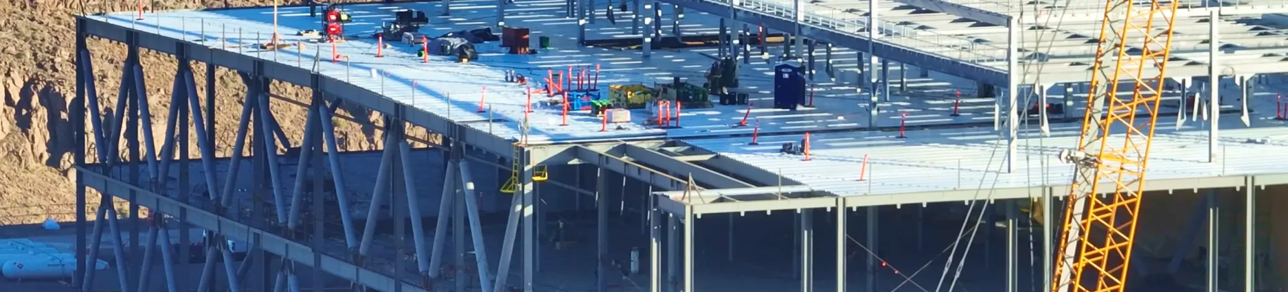
Upgrading the foundation: major aerial and ground platform enhancements
DroneDeploy announced significant upgrades to its aerial and ground platforms, delivering the accuracy, speed and automation features requested by customers.
Enhanced aerial capabilities scale advanced workflows across every project. The platform delivers up to 3x better processing quality and 25% faster processing, with automatic ground control point tagging and expert map accuracy review ensuring survey-grade standards.
Automatic earthworks analysis features include cut/fill quantities by industry standard grid views and quantity exports for instant reporting. New Gaussian Splats visualization provides photorealistic representation of surveyed areas.
"We heard from a contractor in Ohio who used DroneDeploy to validate cut/fill quantities, catching an 18% discrepancy that would have resulted in over $30,000 in unexpected costs," said Winn. "That's the difference between data you hope is accurate and data you know is accurate."
Expanded ground platform capabilities upgrade users from 2D to 3D documentation. New features include mobile 3D scanning with LiDAR, dollhouse/splat/mesh views from standard 360 walks, RTK-enabled mobile scanning with centimeter-level accuracy and measurable point clouds for underground utility tracking, starting with an integration with the Emlid Reach RX. Users can compare 3D data to DXF and IFC design files and export as point clouds or meshes. Enhanced BIM functionality with comparison tools and model revision management will sync with Autodesk Construction Cloud.
A reimagined user experience delivers a completely redesigned Explore interface for the interior view that renders imagery 5x faster and loads XXL projects 100x faster.

Customers seeing immediate impact
“Safety AI has become an integral part of our safety program. It allows Weddle to expand our oversight to every job and get actionable insights for our field teams,” said Tyce Carmichael, Chief Growth Officer and Chief Information Officer at Weddle Bros. Construction Companies. “Safety AI lets us be proactive in identifying and correcting issues, moving beyond basic compliance to a relentless pursuit of safety. Our safety program is better because of Safety AI, and we have the data to back that up.”
“DroneDeploy’s accuracy workflows have transformed how we scale,” said Scott Brown, Construction Technology Manager at Garney Construction. “Automatic verification removes the data bottlenecks and delivers higher accuracy drone data, every time, with less effort.”
About DroneDeploy:
DroneDeploy powers field teams with robotics and AI. As the only reality capture platform that combines robotic automation, AI agents and a truly unified system, DroneDeploy allows critical industries to operate with speed and confidence.
From construction and energy to agriculture, the world’s largest companies use DroneDeploy to simplify field operations, improve safety and make smarter decisions, faster. By combining aerial drones, 360 and fixed cameras, ground robots and proprietary AI, we’re bringing the power of automation and visual intelligence to all stakeholders, from the field to the boardroom.
To learn more, visit www.dronedeploy.com, join the conversation on LinkedIn, YouTube, Instagram and X, and check out DroneDeploy Insider to discover use cases, watch virtual events, download playbooks and get to know our team through our content.
Media contact:
Escalate PR for DroneDeploy
.png)
FAQ

Ready to manage your data from the very start?
Book a quick call to see how DroneDeploy streamlines capture from construction through building ROI.