Get an unbiased view of every roof, facade and lot


.png)


.png)


.png)
.png)

.png)
%201%20(2).png)
Stop sending crews everywhere just to see what changed.
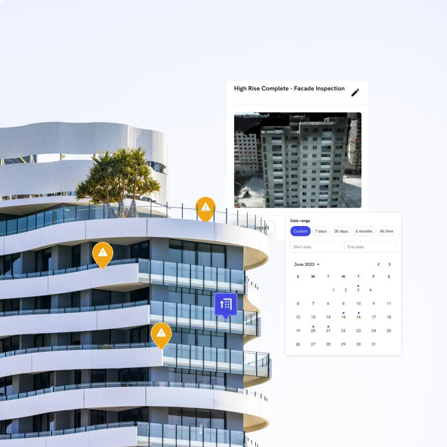
See every asset before you roll a truck.
Put capex where risk is highest.
Keep owners and tenants aligned.
Capture every property from every vantage point

DroneDeploy Aerial

DroneDeploy Ground
Need a full feature list and custom quote?
Build your fleet (or let us do it for you)
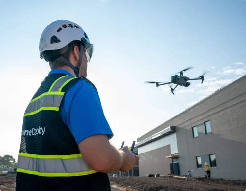
Drones
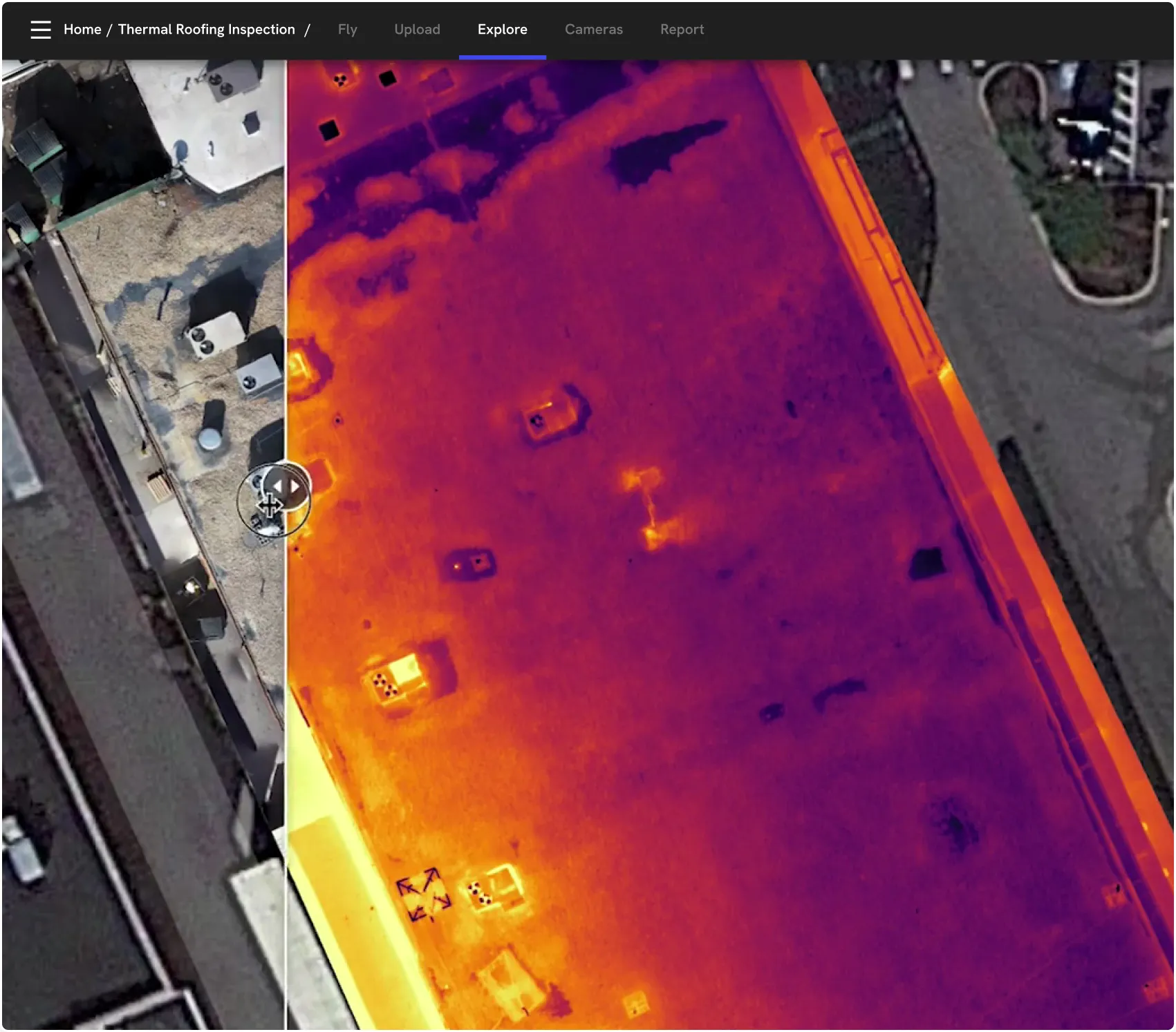
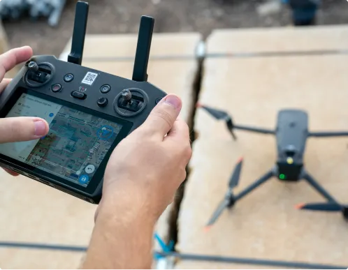
Our drone property inspection software captures high‑res RGB and thermal data across roofs, facades, parking lots and campuses. We support leading enterprise‑grade drones, including simplified RTK/PPK workflows and automated GCP handling when survey‑grade accuracy is required.
360 cameras
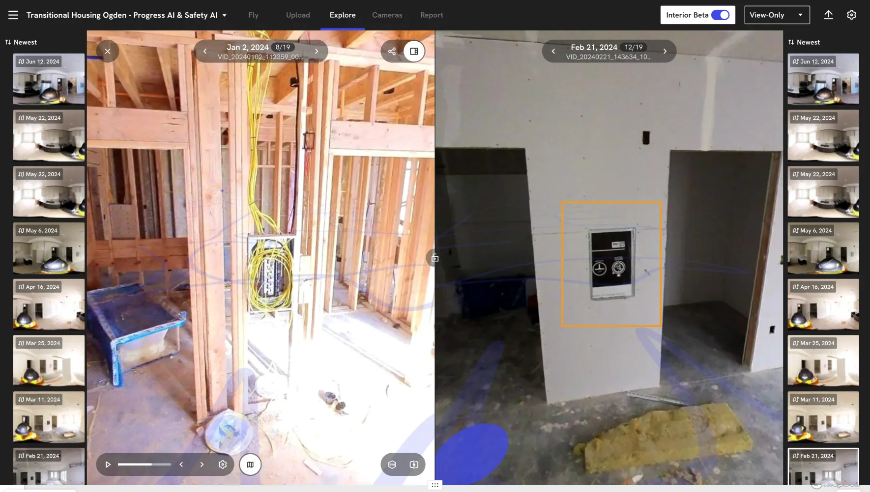
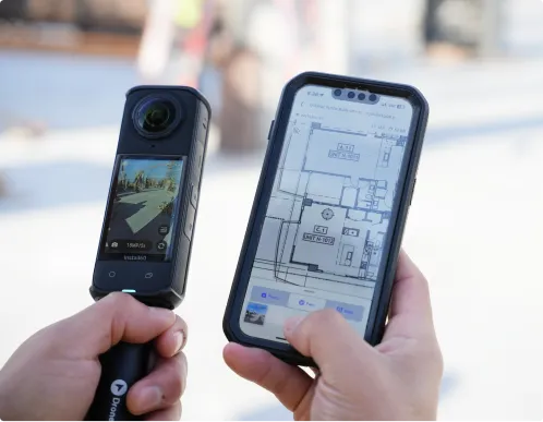
Our building inspection software documents interiors, stairwells, garages and mechanical spaces with fast 360° walks. Give facility teams, vendors and owners virtual access to complex areas without travel or shutdowns.
Docks and robots
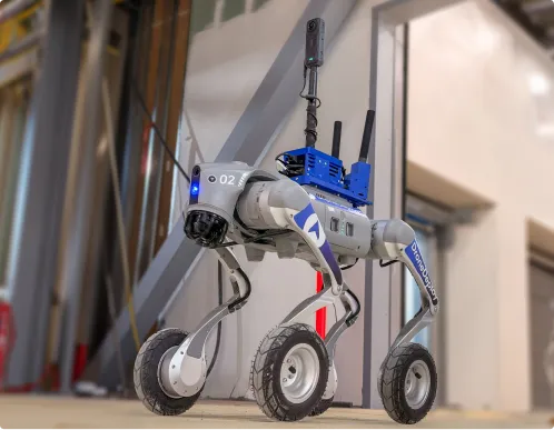
Deploy docked drones and ground robots to run repeatable commercial property inspection routes around large sites, garages and high‑risk areas – creating a consistent visual history without sending people into hazardous zones.
Data on demand
Need the data but don't have pilots or hardware yet? Use our services network to capture roofs, facades, parking lots and campuses at the cadence you need, with processed maps and models delivered straight into your DroneDeploy account.
Don't just collect data – connect it.
.png)
.png)
.png)


Is DroneDeploy the right fit for your operations?
You don’t. You can start with Data on Demand to order drone flights on‑demand, then layer in your own drones and 360 cameras over time as your program matures.
If you’re sending people up ladders or closing lots just to inspect, you’re taking avoidable risk. DroneDeploy lets you capture the same (or better) detail from a distance, with a permanent visual record you can reuse for budgeting, vendor negotiations and claims.
No. It’s for any portfolio where unplanned repairs, safety incidents or claims hurt your margins – from a handful of properties to hundreds of sites spread across regions.
Yes. Enterprise property and facilities management customers use DroneDeploy as a central platform for flight operations and data because it offers encrypted data at rest and in transit, role‑based permissions, and enterprise‑grade controls including SOC 2 and ISO 27001 certifications.
DroneDeploy gives you “eyes on site” in 4K. You can review conditions, approve work and spot risks across multiple properties from your desk, without constant travel.
Yes. Areas, lengths and volumes are calculated directly from your maps and models, so you can scope work, compare bids and justify budgets with objective numbers and visuals instead of rough guesses.
You can begin with services capture or a small in‑house drone program and expand into high‑accuracy mapping and robotics over time. Our team supports program design, training, and best practices so your survey, planning and OHS teams can ramp quickly.

Getting started is simple. Request a demo today.