Find the platform built for your project.
Two platforms. Two different approaches
DroneDeploy
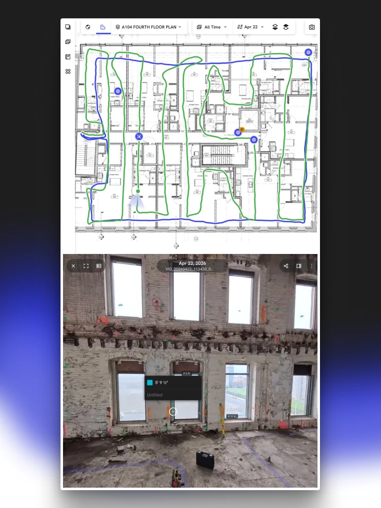
Drone maps align to a coordinate system
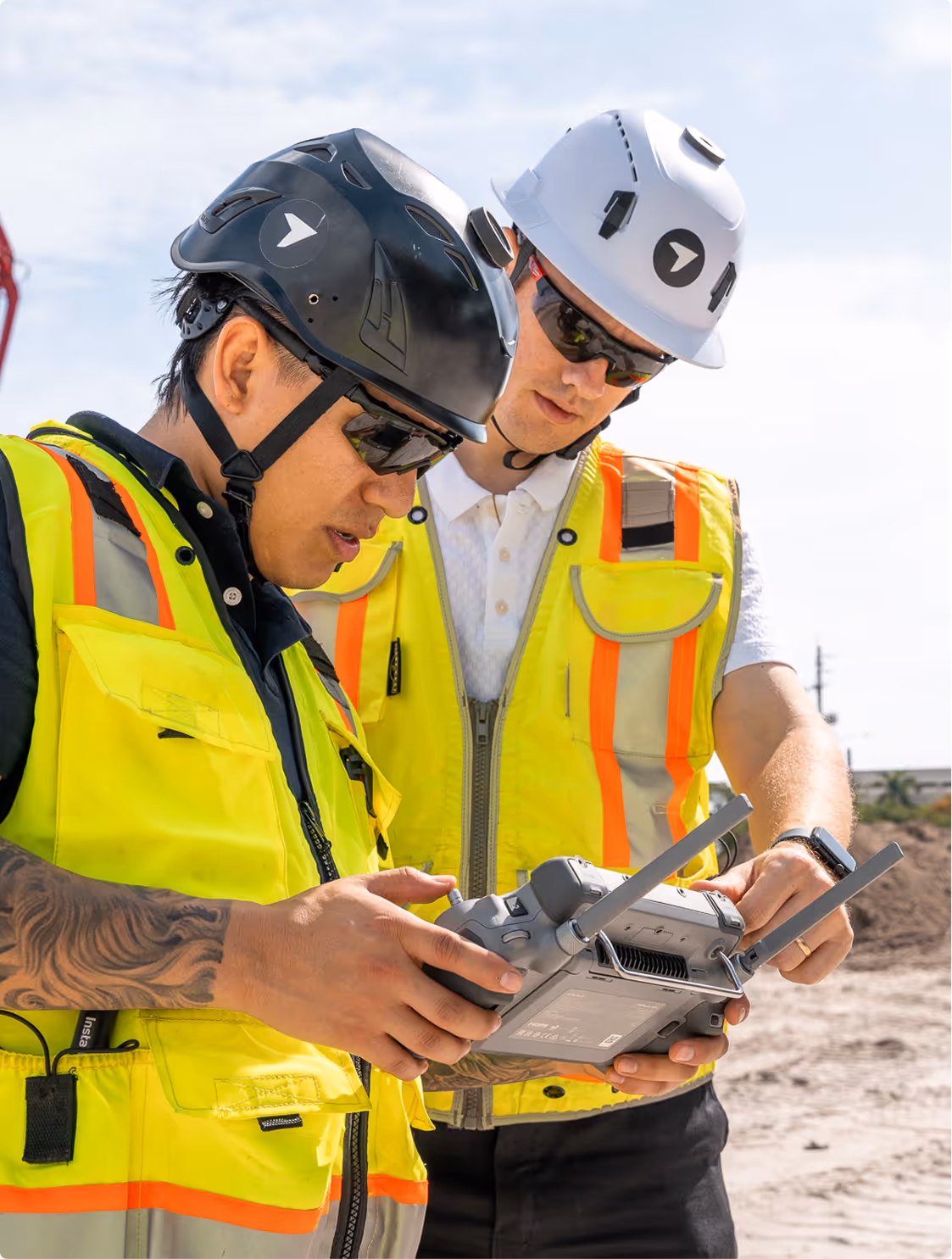
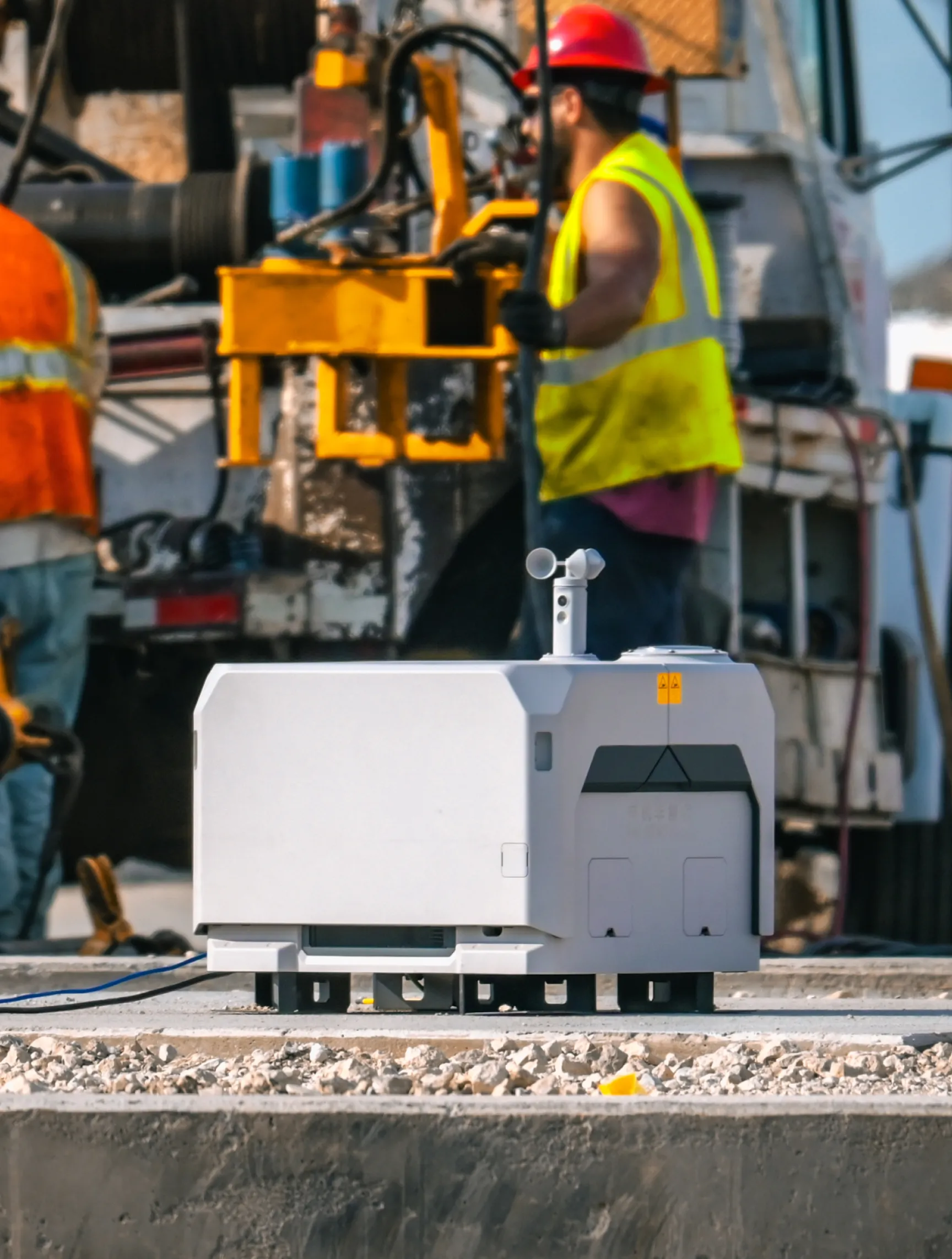
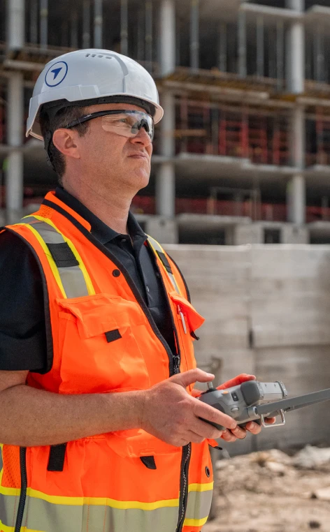
Autonomous site capture
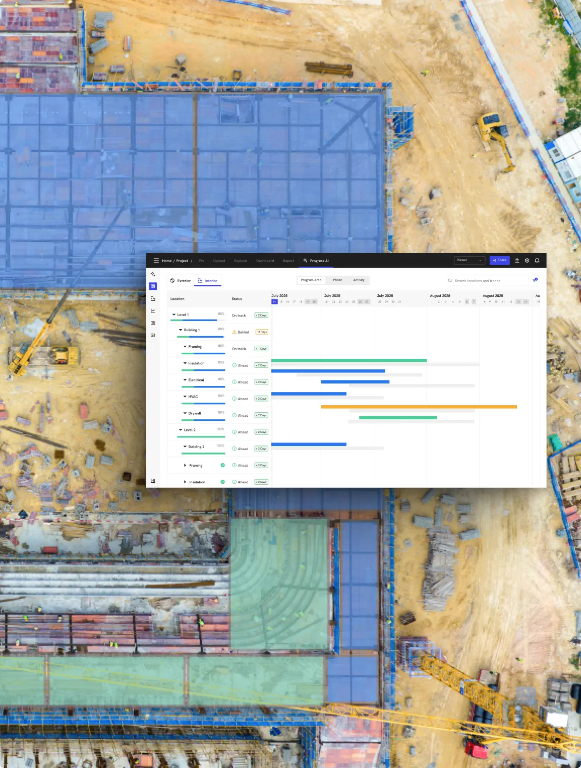
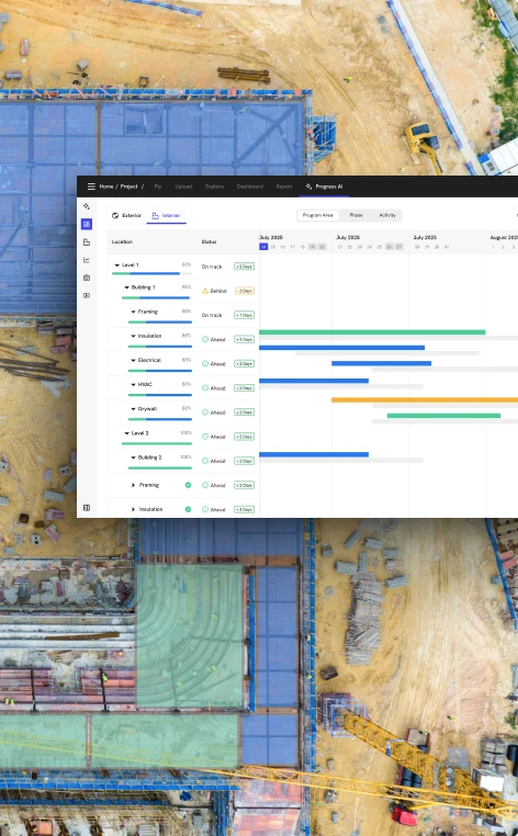
Progress reports in minutes
True 3D data
OpenSpace
Drone maps aligned by a person
Manual capture only
Offshore human experts, ~24 hours
2D and 360 view only
Where OpenSpace has a genuine edge.
AI autolocation for photo mapping
iOS and Android supported. DroneDeploy is iOS only.
Helpful when the site is being regularly and completely captured by at least one teammate, but many others are also taking ad-hoc mobile photos.
Caveat: User feedback implies AI Autolocation functionality degrades once walls are up, as it relies on prior spatial reference data from earlier walkthroughs.
Deeper feature set for BIM compare
OpenSpace’s BIM compare has more features for technical office users – a real advantage on VDC-heavy teams.
DroneDeploy's BIM compare is functional but requires more steps. Flagged as a product gap by customers.
More detail: Field Staff are likely to be happy with DroneDeploy's simple BIM compare solution, while VDC teams may demand the deeper capabilies.
Generally available progress tracking
OpenSpace Track combines AI with offshore human review (via Disperse) – delivering results in ~24 hours. Useful for pay app verification and schedule updates. GA today.
DroneDeploy Progress AI is in early access – currently limited to a select group of customers.
Key distinction: OpenSpace's AI requires offshore human experts to verify results, taking ~24 hours. DroneDeploy's Progress AI is built on modern vision-language models and runs autonomously – delivering reports in minutes. The trade-off today is early access vs. a proven GA workflow.
What OpenSpace does not cover
Mobile 3D scans with RTK
Capture 3D scans with your mobile device, including RTK for mapping underground/subsurface utilities. Not offered by OpenSpace.

Floor & Ceiling Maps
See where materials will prevent the next trade from accessing their work area, reducing delays. With OpenSpace, the user only sees pins and lines on a drawing. With DroneDeploy, users can see the entire floor and ceiling without clicking in.
Measurable 3D walks with dollhouse view
See and measure your interior site walk data in 3D with DroneDeploy.
Survey-grade aerial capture
RTK/PPK centimeter accuracy from every flight. OpenSpace Air accepts uploaded imagery only, which means no mission planning, accuracy verification or dock support.
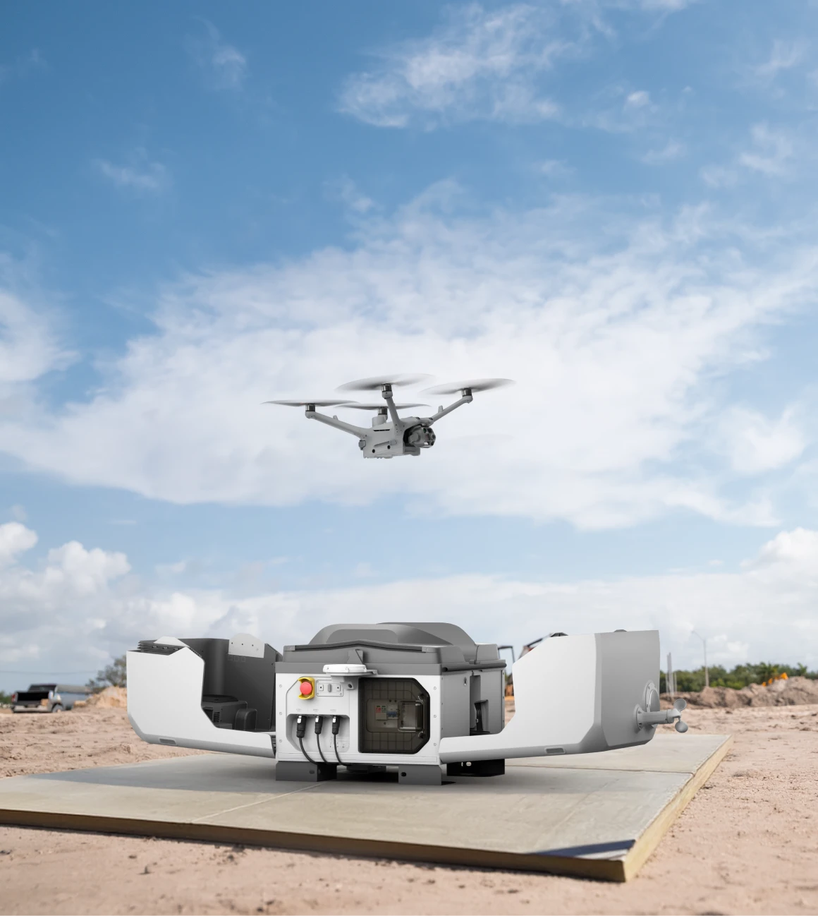
Autonomous flights and docked drones
DroneDeploy connects with drone docks to fly scheduled missions with no pilot on site. Launch, capture, return, upload – all automatically. OpenSpace has no autonomous capture capability.
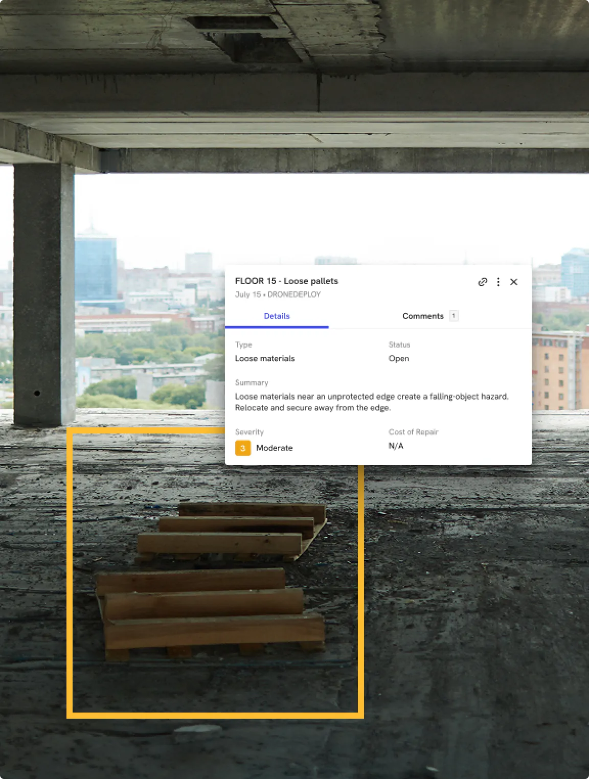
Safety AI, automatic hazard detection
Computer vision scans every capture for OSHA-class hazards – guardrails, PPE, fall risks – and surfaces findings with exact location references. OpenSpace has no safety AI.
Progress AI, results in minutes
Automated percent-complete by scope against your schedule, in minutes. OpenSpace Track (via Disperse) returns results in ~24 hours.
Flight services
DroneDeploy dispatches a certified pilot to your site – you set the requirements, they handle the rest. OpenSpace has no aerial capture service equivalent.
Full GIS + cloud integrations
Connects to Procore, Autodesk Construction Cloud and BIM 360. Exports GeoTIFF, LAS, DXF and OBJ. OpenSpace integrates with Procore for 360 links – DroneDeploy connects across the full project data stack.
.webp)
.gif)
.webp)
One platform across the entire project. Not just the interior.
What industry leaders are saying
Feature comparison
Which platform fits your project?
Two different tools built for two different scopes of work.
Here's how to tell which one fits.
DroneDeploy
Total sq feet captured: 20 trillion
Large GC and owner teams managing the full project from preconstruction to closeout.
OpenSpace
Total sq feet captured: 60 billion
Smaller sites and interior-only teams where manual 360 capture and BIM overlay are the primary workflow.
DroneDeploy has become our field coordination tool. Our teams have latched onto being able to view all aspects of their job at all levels.


.png)


.png)


.png)
.png)

.png)
%201%20(2).png)
Is DroneDeploy the right fit for your project?
It depends on how your team uses OpenSpace today. If interior walkthroughs are your primary workflow, DroneDeploy covers that and adds aerial, Safety AI and autonomous capture. For small GCs or subs focused on interiors only, OpenSpace may be the right fit. For large GCs and owners needing coverage across the full project lifecycle, DroneDeploy is the broader platform.
OpenSpace Air processes imagery uploaded from any drone. DroneDeploy plans the mission, controls the hardware, verifies accuracy with RTK/PPK and analyzes the output automatically. One is a viewer. The other is a platform.
Any time a number has money behind it: pay applications, cut/fill reconciliation, grade verification, stockpile quantities. A visual record and a verified measurement are two different things.
OpenSpace Track uses AI plus human expert review via Disperse. Results return in approximately 24 hours at 95% reported accuracy, suited for pay application sign-off. DroneDeploy's Progress AI is fully automated and returns results in minutes. Currently in early access and great for pay applications, but also best for internal scheduling decisions and rapid lookaheads.
DroneDeploy's Data on Demand network dispatched over 10,000 flights last year. You define the site and requirements, DroneDeploy handles dispatch, compliance and delivery. OpenSpace has no aerial capture service equivalent.
DroneDeploy's customer success team manages migration directly. DroneDeploy includes on-site onboarding and training for up to 20 people.
Getting started is simple. Request a demo today.